

LA ROQUEBROU
Auvergne Rhône-Alpes, Cantal
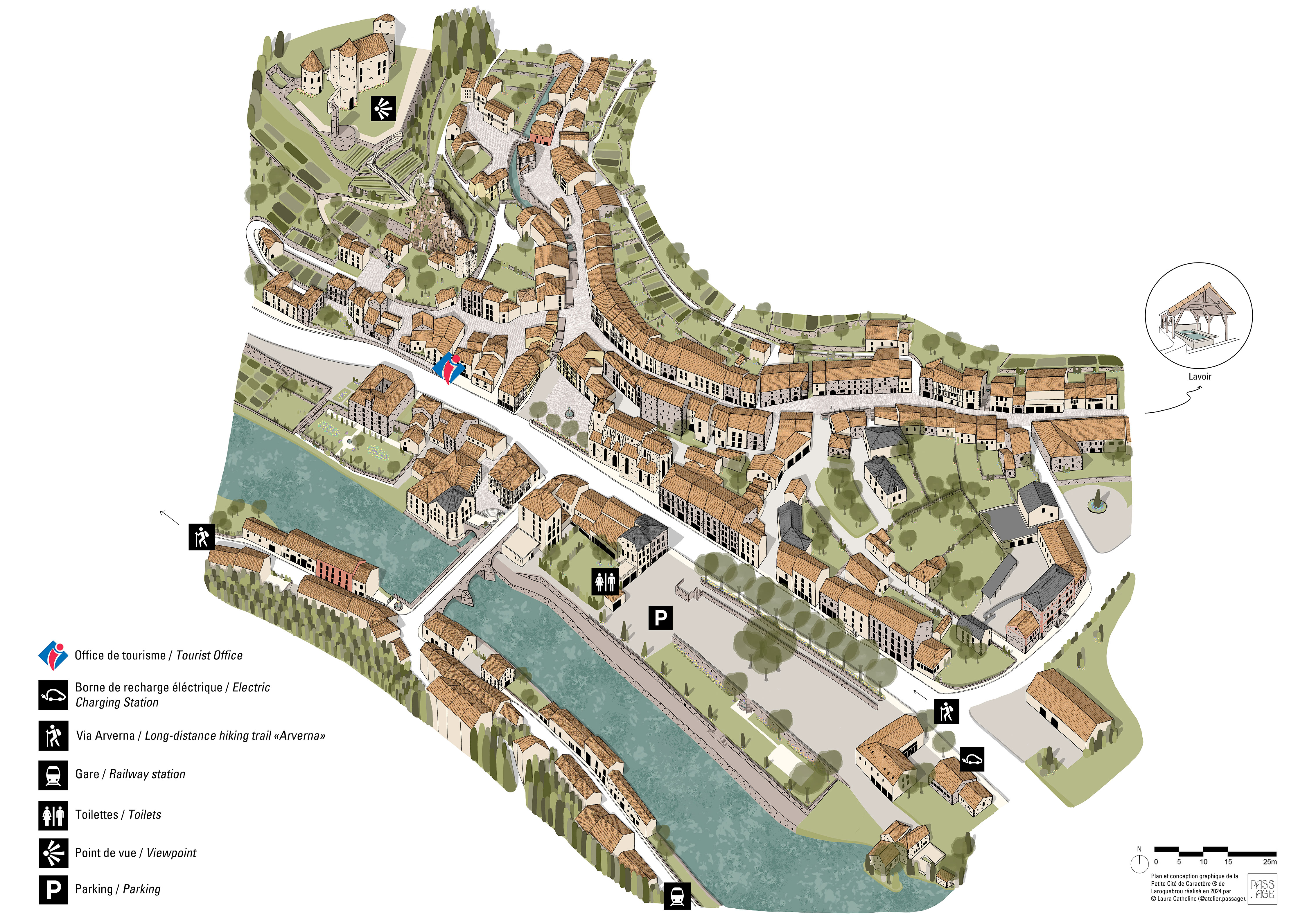
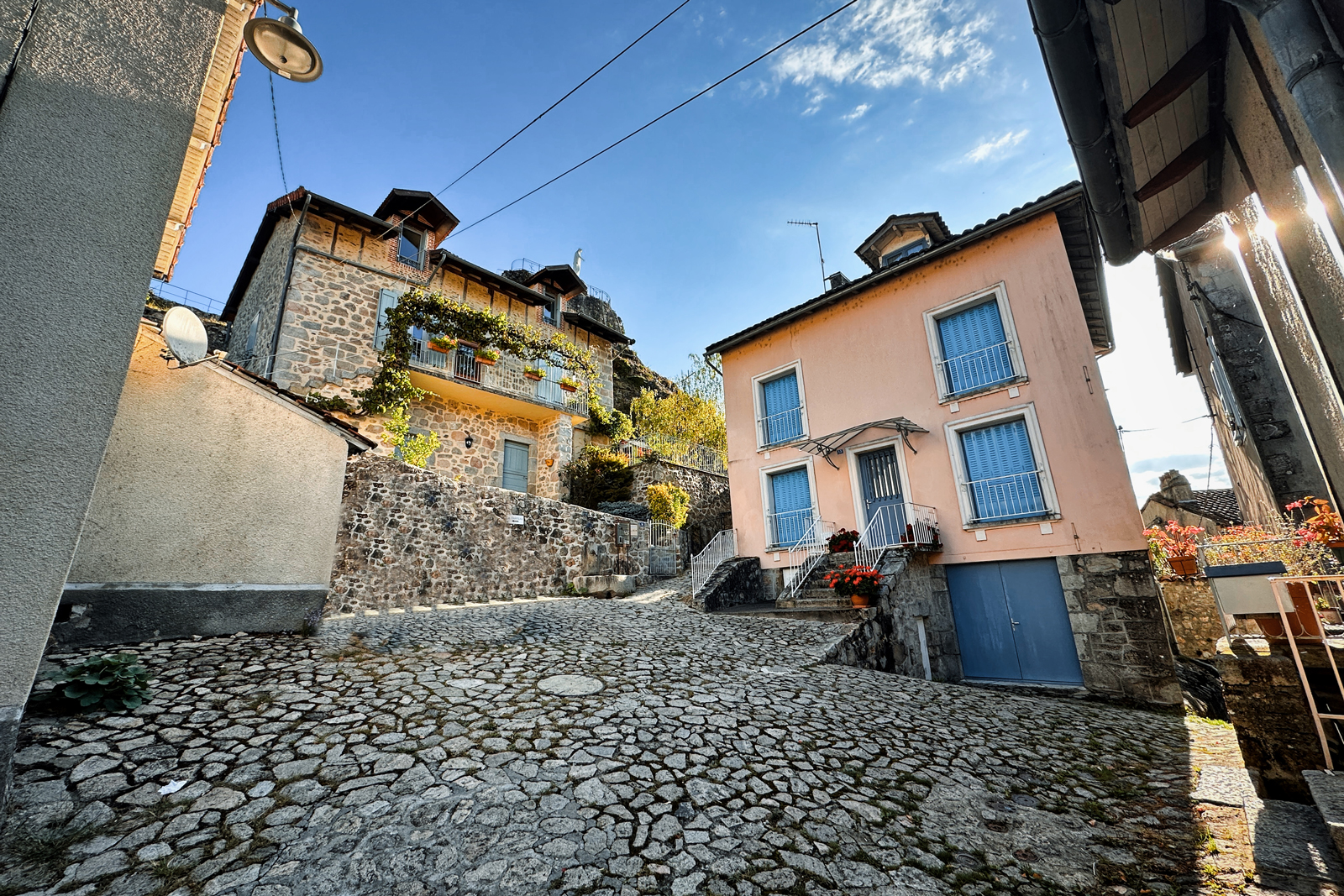
La Roquebrou, Petite Cité de Caractère®
Laroquebrou is designated Petite Cité de Caractère®. As such, it forms part of a national project aimed at promoting and protecting the architectural heritage of little towns across France. Through tourism, the initiative encourages visitors to embrace the local culture by strolling through the streets, learning about the history of the area, taking part in local events, and discovering the local way of life. In Cantal, there are several Petite Cité de Caractère® little towns to discover. The digital map will help you navigate each of them and highlight their main attractions.
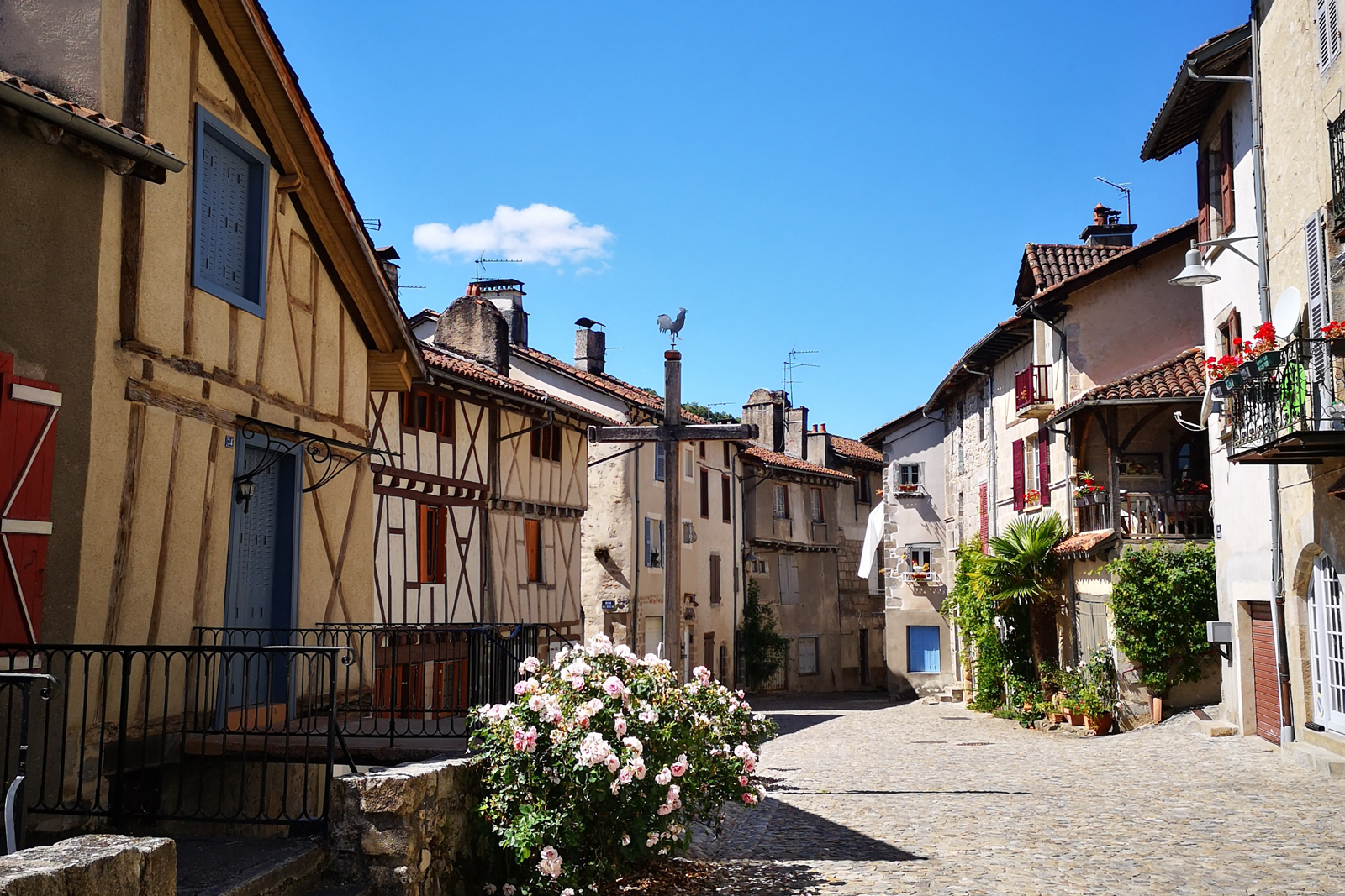
La Roquebrou, a castle town
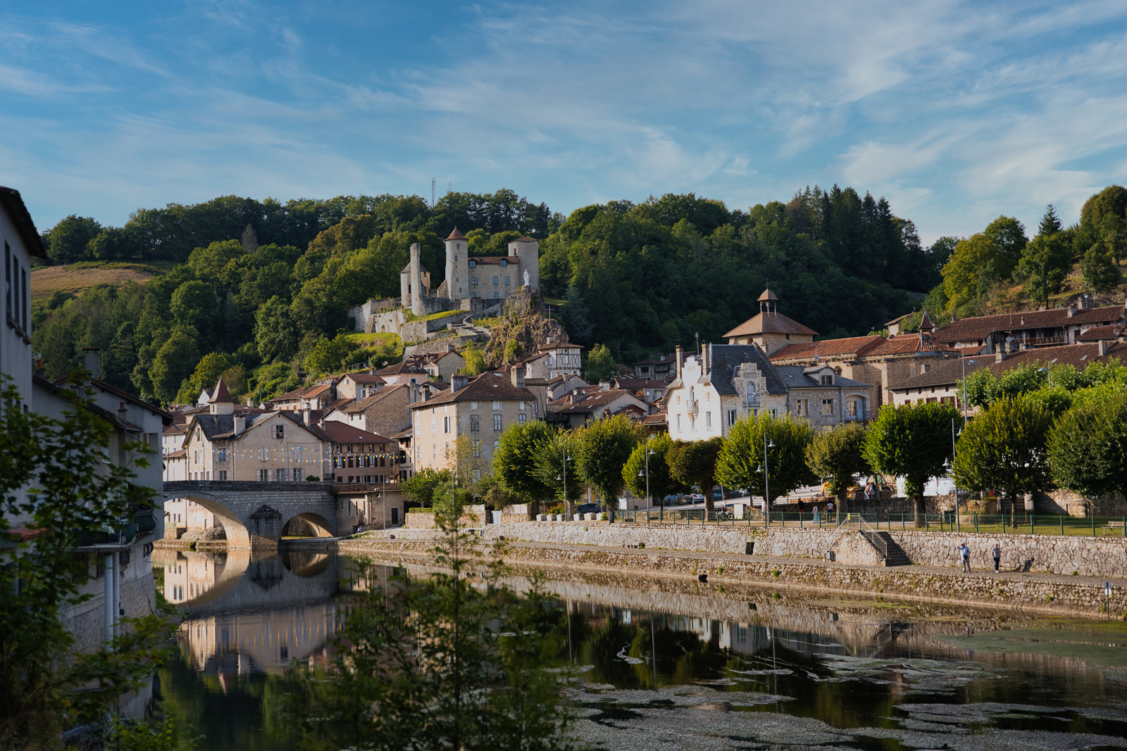
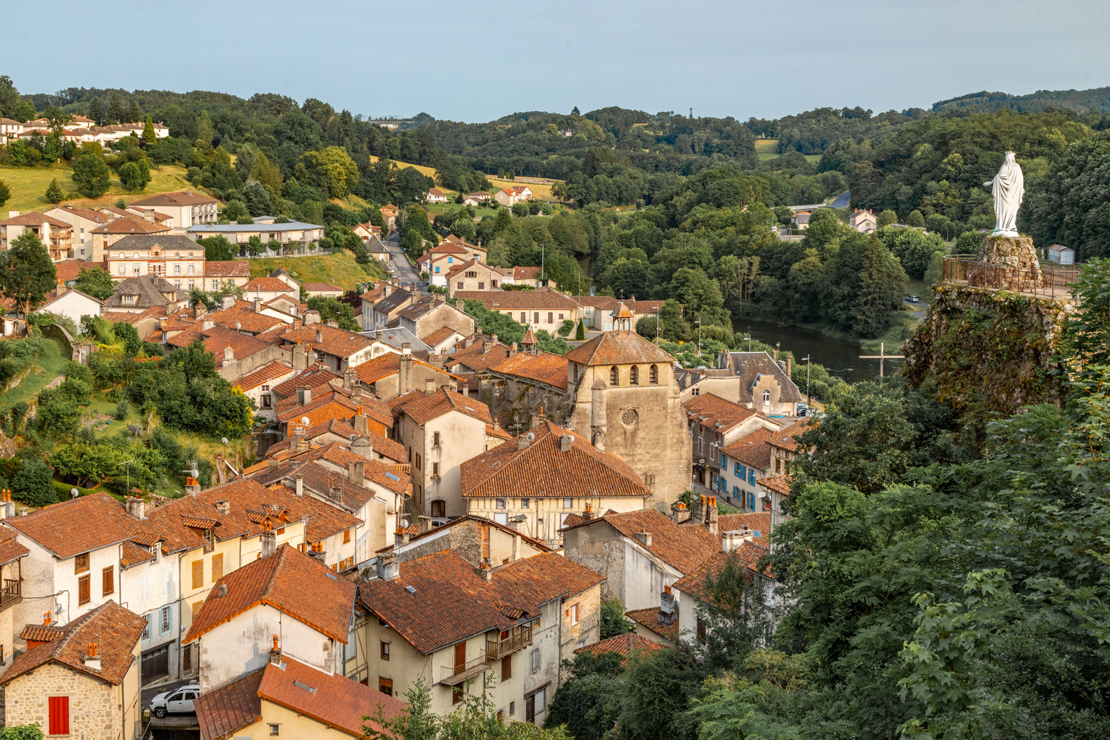
Located in the Châtaigneraie Cantalienne, gateway to the Cère Gorge, La Roquebrou was built around the castle on a rocky spur. In the Middle Ages, it was a lively cultural centre and the castle was a protective bulwark for the population against the Anglo-Saxon invasion. The city developed from the 10th to the 15th century. As a matter of fact, the ancient fortress town began to thrive as the first bridge which crossed the River Cère was built. Agricultural activities and numerous crafts settled in La Roquebrou : tanneries, cobblers, weavers and potters. Notre-Dame du Rocher and the medieval castle overlook the oldest part of the little town, with its steep streets, timber-framed and corbelled houses and door lintels engraved with medieval dates. Influenced by the architecture of neighbouring Quercy, the medieval town remains the ‘Gateway to the South’.
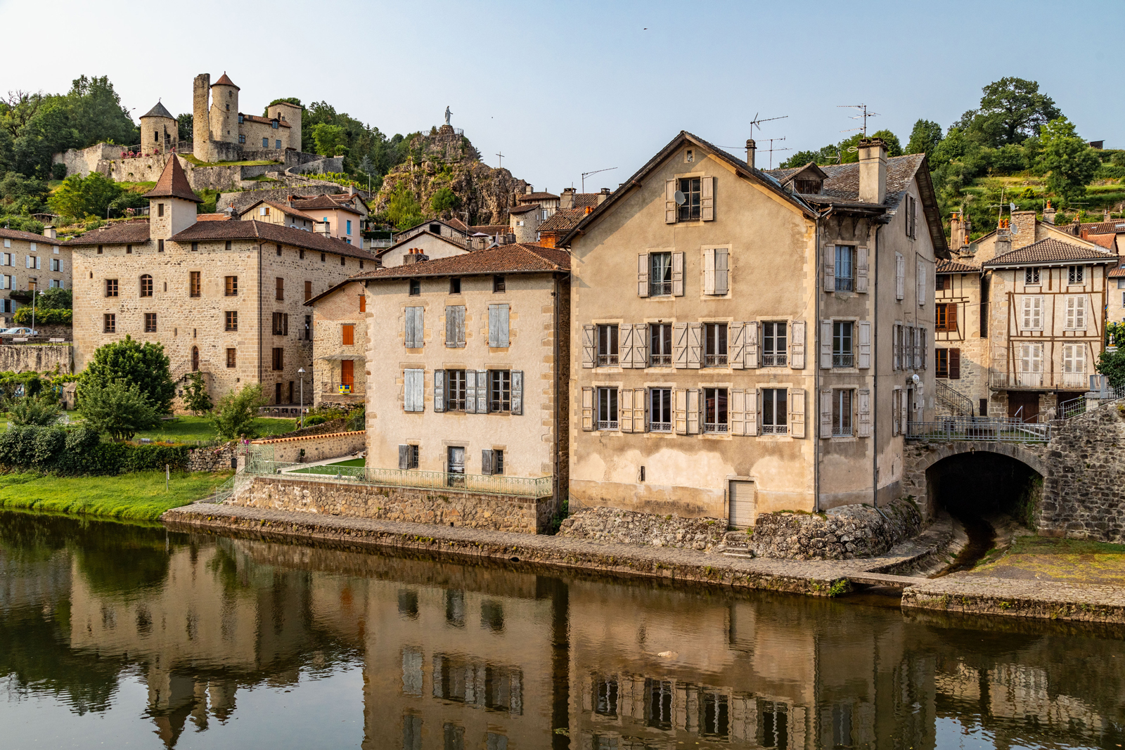
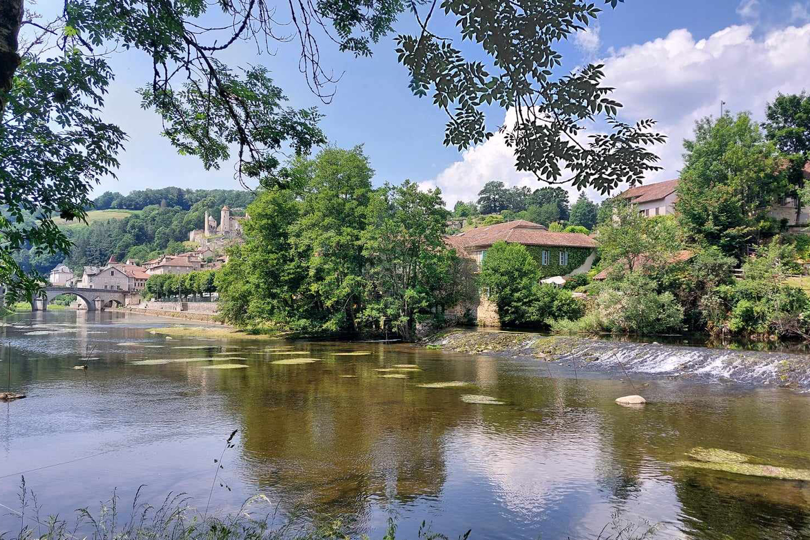
Left bank of the River Cère
From this spot on the left bank of the Cère, you can get a splendid view of the medieval town: the castle on its promontory, the church and the chaplain’s house, the bridge and the houses. On the right bank of the river, under the quays built around 1960, the Nègrerieu Brook flows into the Cère on the left-hand side of the bridge and the Reclus Brook on the right-hand side. In the background, to the right of the castle, the terraced gardens face south. From the Middle Ages until around 1980, each inhabitant had his own garden. On the far right, on the banks of the Cère, a mill was once the lord's grain mill. It is called the moulin de la Peissière’.
Bridge over the river Cère
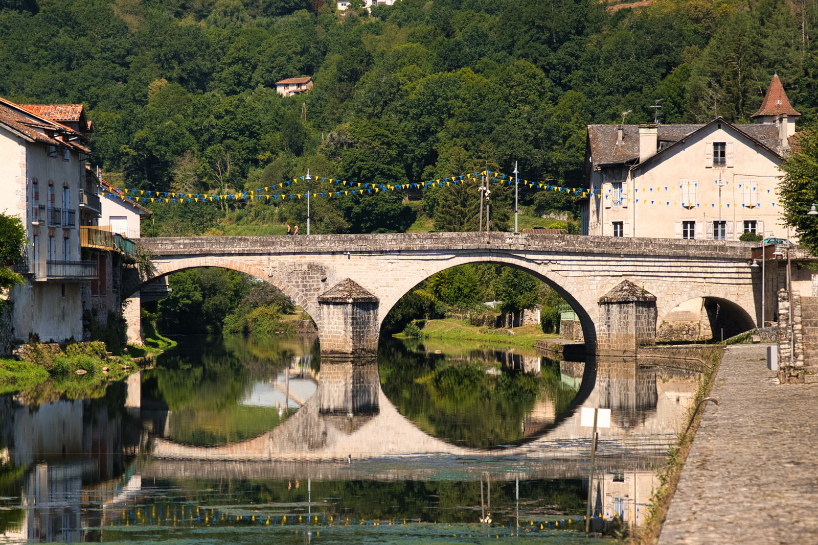
The bridge over the Cère is built of granite stone with three arches and strong cutwaters. Built in the 13th century, it contributed to the economic development of the town. As the only crossing point over the Cère, it made access from the Aurillac area to South West France easier. Lined with houses and shops in the early Middle Ages, it was fortified when times became less secure. This allowed the lord to impose a toll, which was abolished during the French Revolution. Adjacent to the bridge, Place Sabathier was a crossroads leading to one of the town gates: the Porte del Fort. Between 1817 and 1850, the widening and the heightening of the bridge gave it its present-day appearance.
Hôtel de la Trémolière, the town hall
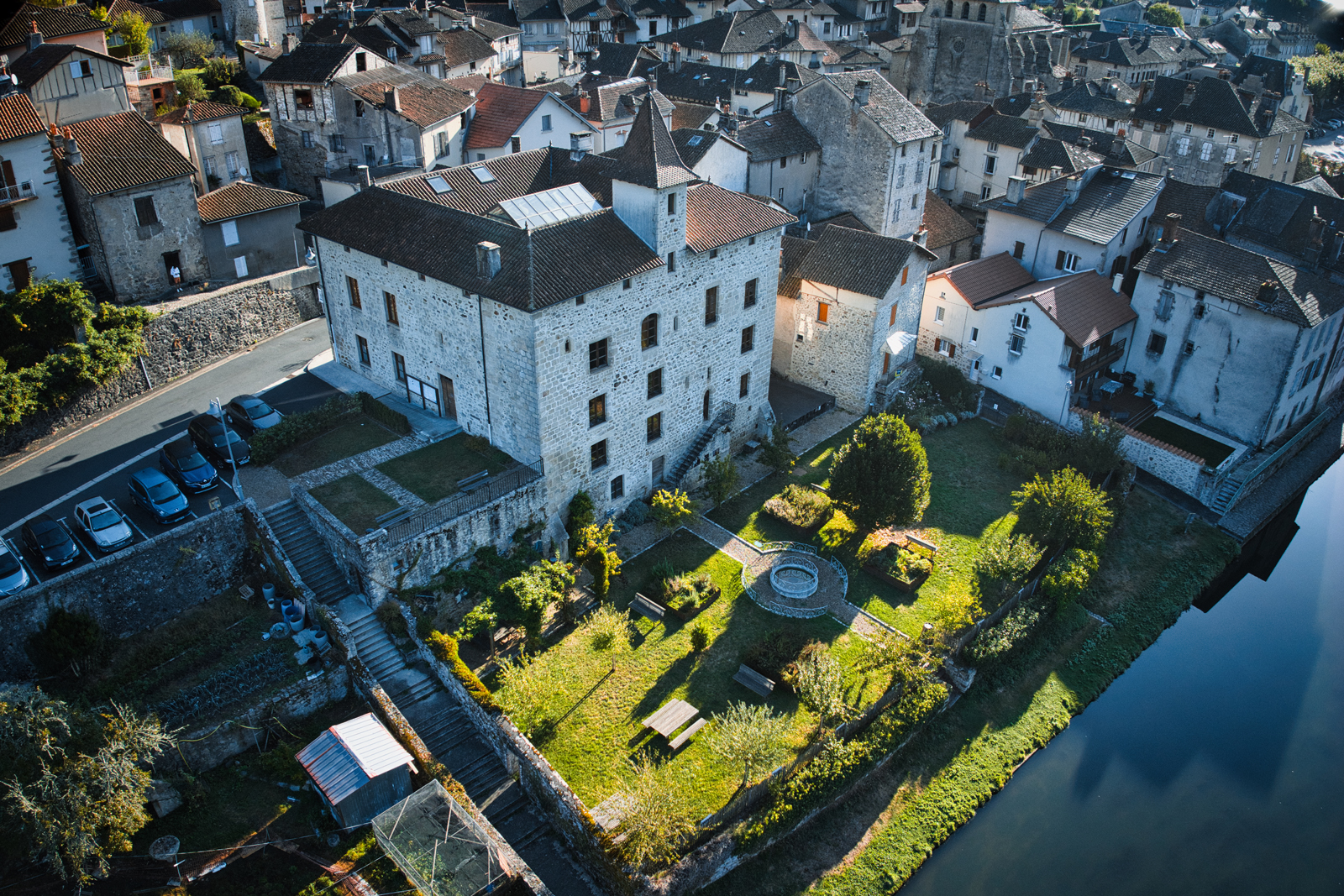
The town hall is housed in the former chaplains house of La Trémolière. Built at the beginning of the 14th century, the house was donated by Géraud de La Trémolière in 1342 to create a religious institution with charitable and educational aims. The particularly elaborate entrance portal is listed as a historic monument, as is the woodwork in the town council room. The other openings on the ground floor, and most of the large windows on the first floor, date from the 19th century and were designed to provide light for the classrooms of the boys' school, which moved into the building along with the town hall after the French Revolution. The south façade, with its ogival doorway on the first floor, overlooks the Tremolière Garden, which was beautifully renovated in 2017 as a public garden.
Place de la Frugière
The charming labyrinth of cobbled streets was part of the original fort. The local spring provided water for the inhabitants before running water was available. Once known as the ‘Frégière’ or ‘Cold Quarter’, it is likely that special facilities were built here to keep ice or food cold. This area is full of typical houses, including the large house behind the fountain. Located at the foot of the Rock of the Virgin, this house is an old fortified medieval house. The square house leaning against the rock is known as the ‘Chick House’. According to a local legend, it was home to the many mistresses of the lords of Montal! Its architecture is similar to that of the castle: a tower with a spiral staircase and doors with an ogee arch.
Château de Montal
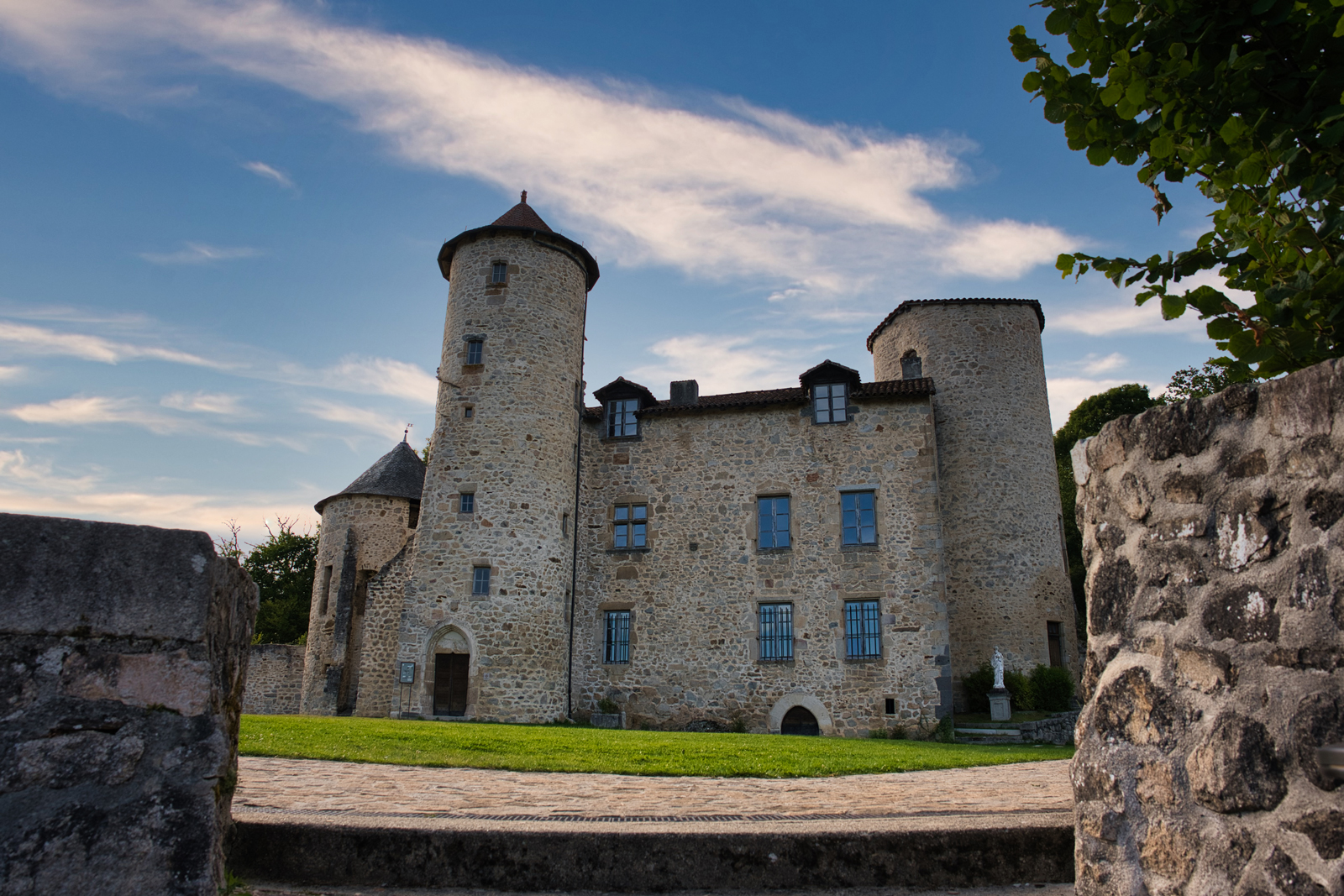
Built on a rocky spur strategically located at the entrance of the Cère Gorge, the castle was inhabited by the Montal family from the 13th century. From the 14th century, the castle was gradually extended. The completed castle had a beautiful appearance, with seven towers, two large buildings on either side of the staircase tower and a covered walkway. It was surrounded by walls with two large defensive gates (including the so-called ‘Bridge Defensive Gate’) and three gates giving direct access into the enclosure. From the end of the 16th century until the French Revolution, the castle belonged to the Marquess of Peyrusse d'Escar since Rose de Montal married François de Peyrusse d'Escars. In 1793 the château became a national property and from 1840 belonged to several successive owners. Its stones and beams were plundered for new structures down the years.
Montal Castle Esplanade
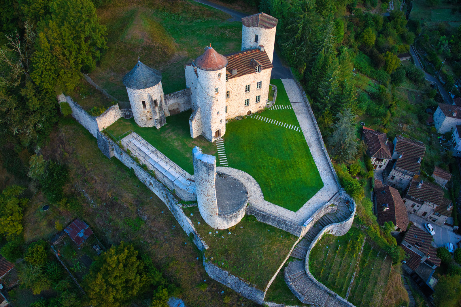
The town of La Roquebrou became the owner of the castle only in 1962. Thanks to the voluntary work of a local association, the building has been saved thanks to the re-roofing of the central building and the west tower. Renovation work was carried on by the various town councils. Today, the château hosts exhibitions during the summer and its esplanade offers a landscaped area reminiscent of the former garden, with one of the best views of the little town. Recent improvements highlight the gardens: 105 vines have been planted including 50 golden chasselas / Hamburg muscat grape vines and 55 cardinal / regina vines.
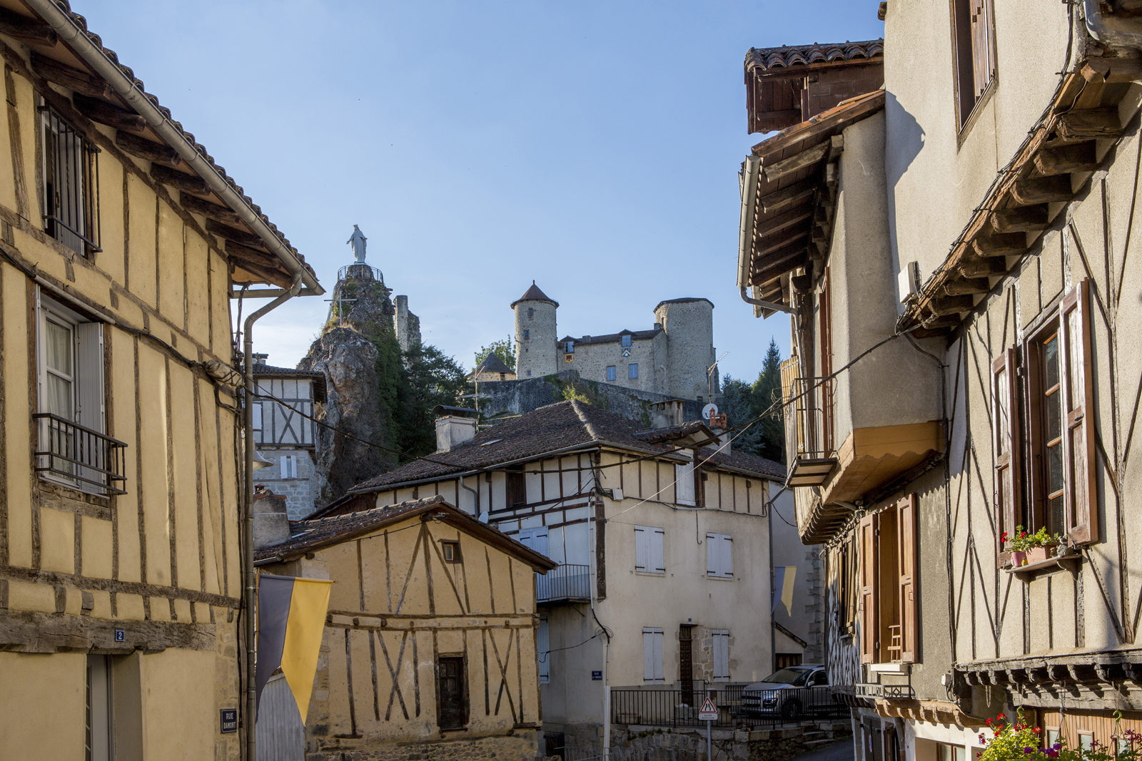
Rock of the Virgin
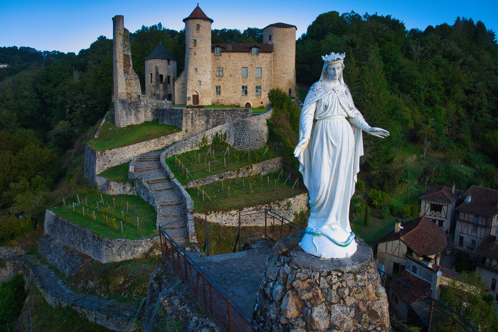
The Rock of the Virgin is a quartz dyke, i.e. an eruptive rock that has retained its original shape. Erosion has separated it from the promontory of the castle, and a vein of quartz dyke extends further down, in the Rue du Fort. There, a curious house seems to be eating a block of it. The statue of the Virgin, unveiled in 1887, is a copy of that of the Basilica of Notre-Dame de Fourvière in Lyon. It replaced a medieval square tower called the ‘Tour Del Moussou’ or “Lord's Tower”. This tower, built on the rock to increase the feeling of dominance, probably gave the place its name of ‘La Roque’. The tower already housed a chapel dedicated to the Virgin Mary.
Place du Merle
This charming square located within the old ramparts was connected to the Rue Nègrerieu by a gate near the bridge over the brook. It is surrounded by several beautiful medieval houses. Near the bridge, on the right-hand side of the Rue Nègrerieu, a beautiful square house was used as a courthouse from the 17th century onwards. From the bridge you can see the Nègrerieu Brook, which is covered downstream until it flows into the Cère. This brook was very useful to the town, as it powered several mills, including one specialising in leather tanning. It was also used as a defensive ditch due to its depth.
Rue Nègrerieu
This street owes its name to the brook, the ‘Rieu Negre’, which means the ‘black stream’ in Occitan. Its name may have come from its ‘black angers’, its violent floods during heavy rainstorms. The street constituted a second suburb populated mainly by artisans: weavers, potters and above all trades related to leatherwork: tanners, shoemakers, saddlers, parchment makers and clog makers. The house bearing the plaque paying tribute to Raymond Four, an Occitan poet, belonged to a wealthy family of tanners.
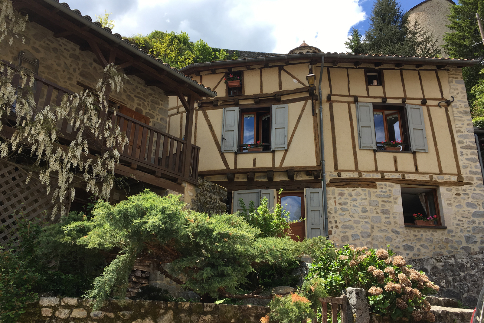
Rue Damont
The Rue Damont (or Rue d'Amont, i.e. the street running upstream from the River Cère) was a suburb where merchants and craftsmen settled to benefit from the passage of travellers and goods that crossed the bridge. Some of their houses made of ashlar blocks are still visible, with their ogival-arched doors and mullioned windows, as well as half-timbered houses. The Reclus Brook is hidden by the street leading down to the market square. Its name comes from the cell that used to be home to a ‘recluse’. In the Middle Ages, recluses were very pious persons who sacrificed their lives by being secluded in order to atone for the sins of the entire population. Until the 19th century, the brook ran in the open air in front of the hospice and was used by tanners to clean the hides.
Maison Buc and Place du Coq Roquais
At the heart of the medieval quarter, on the Place du Coq Roquais, you can admire the Maison Buc, dating from the 13th or the 14th century, with its three large arcades and its narrow ogival doorway. It probably belonged to a wealthy merchant. In the Renaissance, a restoration gave the house mullioned windows (broken in the 19th century) and an interesting canonical sundial carved in one of the stones of the façade. A man of religion lived there and the sundial enabled him not to miss the times of prayer.
Hospice
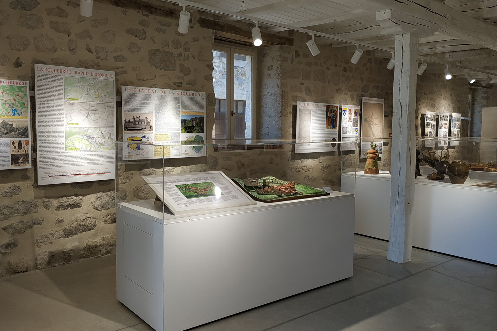
A hospital and a hospice were founded here in 1300 at the entrance to the town from Aurillac in order to limit the spread of diseases: Ill travellers had to stop there. The north façade has survived since the 14th century, with its two ogival doors, the one leading to the hospital and the other to the chapel. The hospital was supported by numerous donations. In the 17th century, Louis XIV wanted to recover the revenue of the leprosaria, believing they were no longer of any use and needing money to treat the wounded soldiers. Fortunately the hospital of La Roquebrou proved its usefulness, as evidenced by the inscription ‘Confirmed in 1705’ on the medallion above the entrance door. The building now houses an exhibition room on the history of the town, a media library and a community pottery.
Mill of La Pessière
The central pillar, which supports the two vaults, still bears the carved traces of the Montal family coat of arms. It is a reminder of the noble origins of this mill, which was sold as a national property in 1794. In addition to milling, it was then used for carding, dyeing and weaving. Its activity ended in 1956.
River Cère
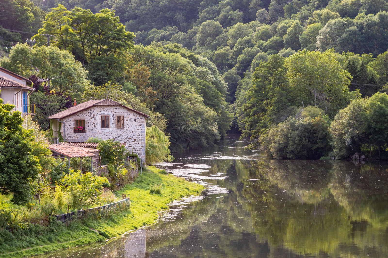
It all started with a legend: A little nymph helped Ceres, the goddess of the harvest, to find her daughter, taken to the underworld by Pluto. When the nymph was threatened by Apollo, Ceres saved her and turned her into a river, which was named the Cère. In the first half of the 20th century, the River Cère was still rich in fish. Many species of fish were caught including trout, which fly-fishing specialists still know how to entice !
St Martin’s Church
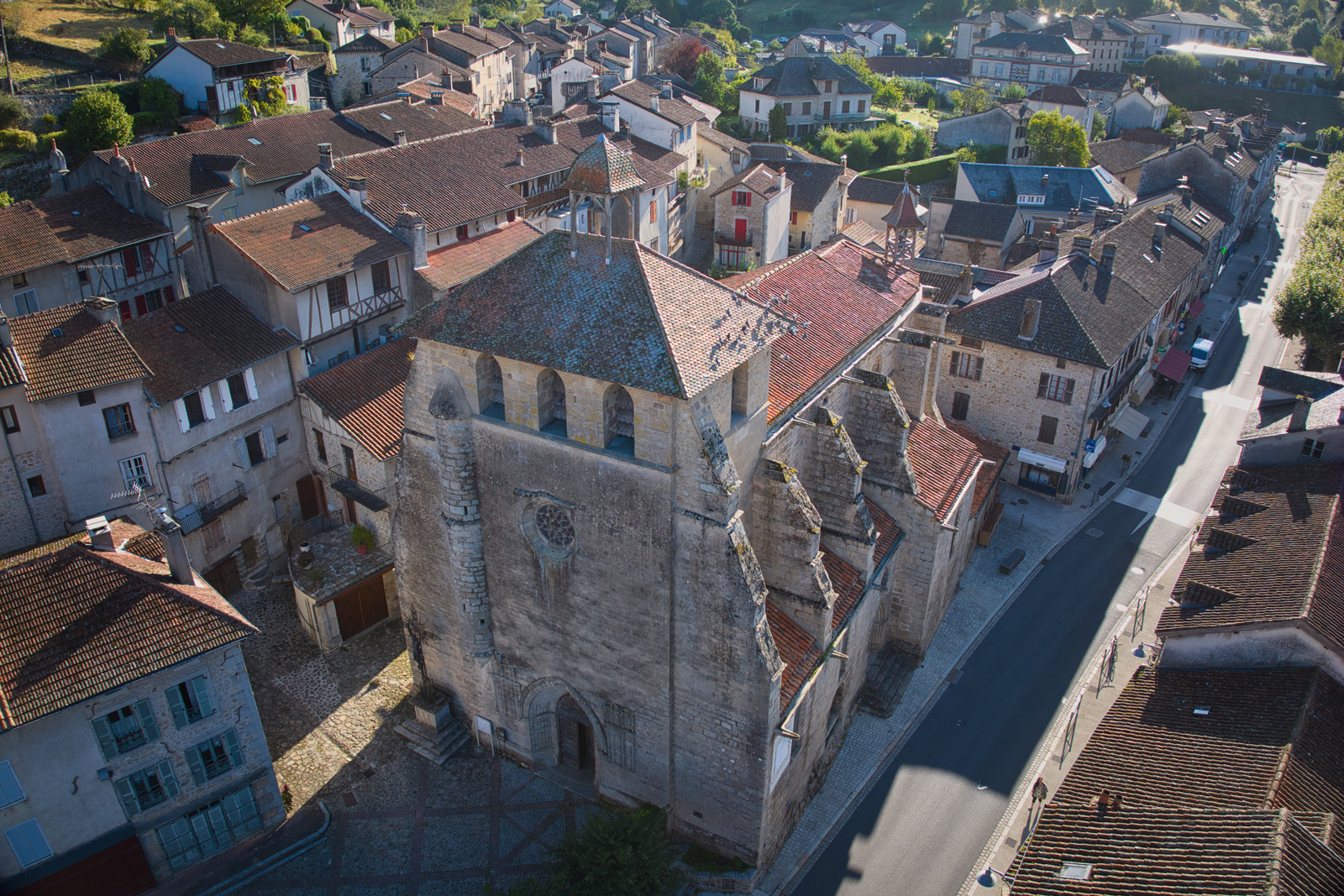
This Gothic church was built in the 14th century and financed by the inhabitants of the fort and the suburbs. Dedicated to Our Lady of Mercy, it was the collegiate church of the community of priests. At the end of the 17th century, the original church of St Martin, located on Brou Hill, was demolished. As a result, the name "Our Lady of Mercy" was abandoned in favour of its current name: St Martin's Church. The church has some beautiful paintings and two large wooden statues representing Saint Martin and Saint Roch. On the bell tower you can see the protruding spiral staircase, above which are three bells: two from the 19th century and a third from 1593. On the south side (today a street) was the cemetery, moved during the French Revolution. The south door was used to transfer the dead from the church to the cemetery. It is topped by a star-shaped opening.
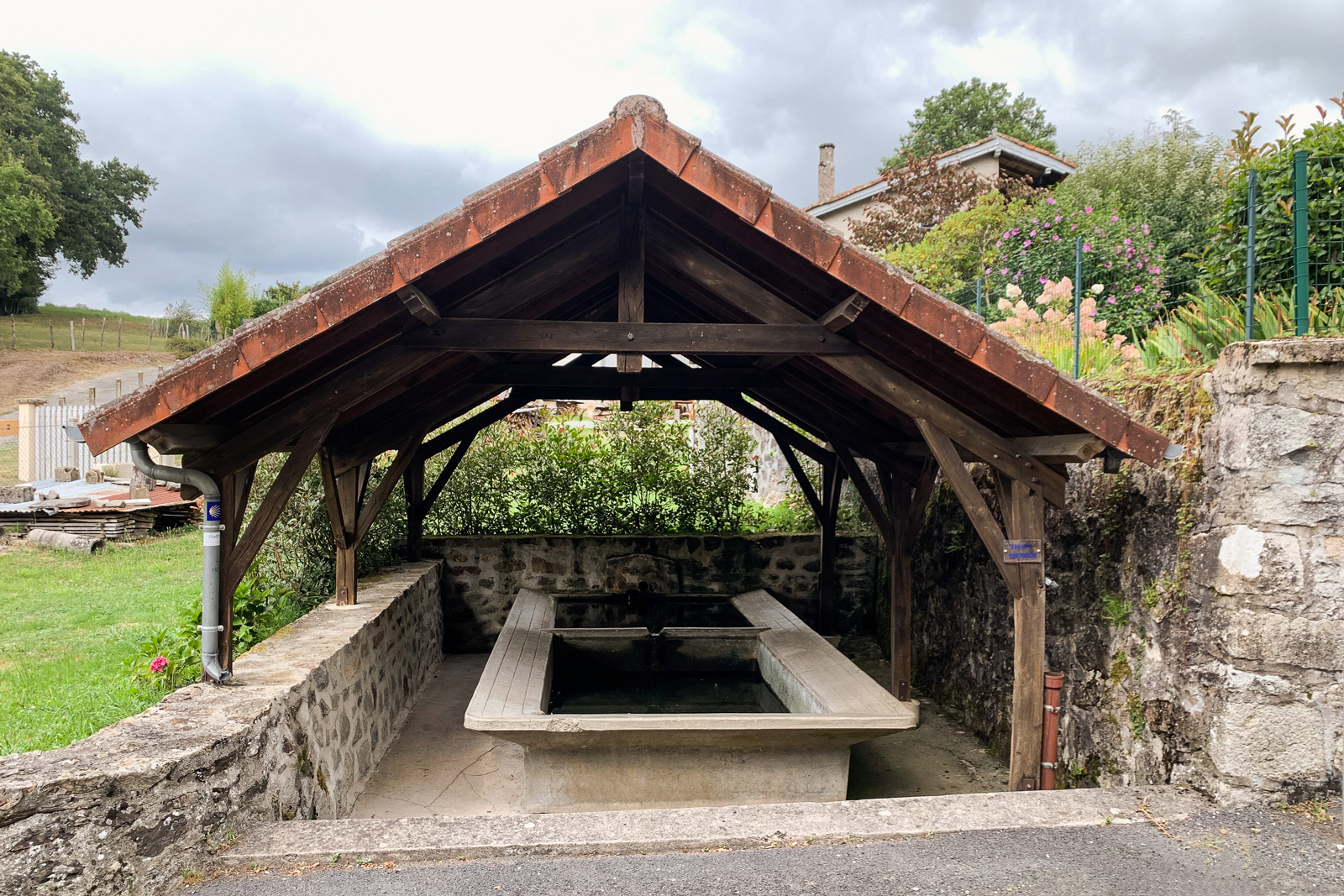
Fountains and Washhouses
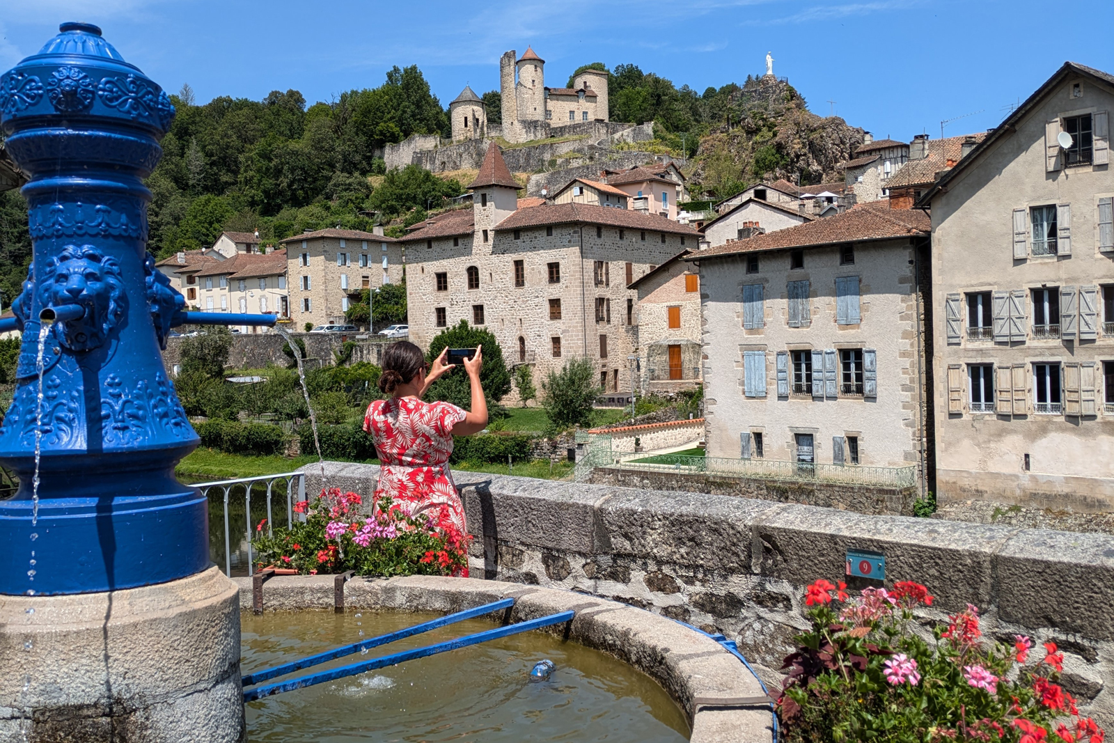
The little town boasts a number of fountains designed to supply water to the various neighborhoods: The Clavière Fountain (Rue de la Gare), the fountain at the end of the bridge (1870), the fountain on Place de l'Église (1838), the fountain on rue Nègrerieu near the bridge over the brook (1892), the fountain on Place de la Frugière, the fountain on Place du Coq Roquais and the fountain near the hospice. There are also three public washhouses: in the Rue Nègrerieu (1912), on the road to Montvert (1912), and at the end of the Rue Damont (1932). Both fountains and washhouses were meeting places. People chatted there while waiting for their buckets to be filled or while doing their washing.
Fountains and Washhouses
The little town boasts a number of fountains designed to supply water to the various neighborhoods: The Clavière Fountain (Rue de la Gare), the fountain at the end of the bridge (1870), the fountain on Place de l'Église (1838), the fountain on rue Nègrerieu near the bridge over the brook (1892), the fountain on Place de la Frugière, the fountain on Place du Coq Roquais and the fountain near the hospice. There are also three public washhouses: in the Rue Nègrerieu (1912), on the road to Montvert (1912), and at the end of the Rue Damont (1932). Both fountains and washhouses were meeting places. People chatted there while waiting for their buckets to be filled or while doing their washing.
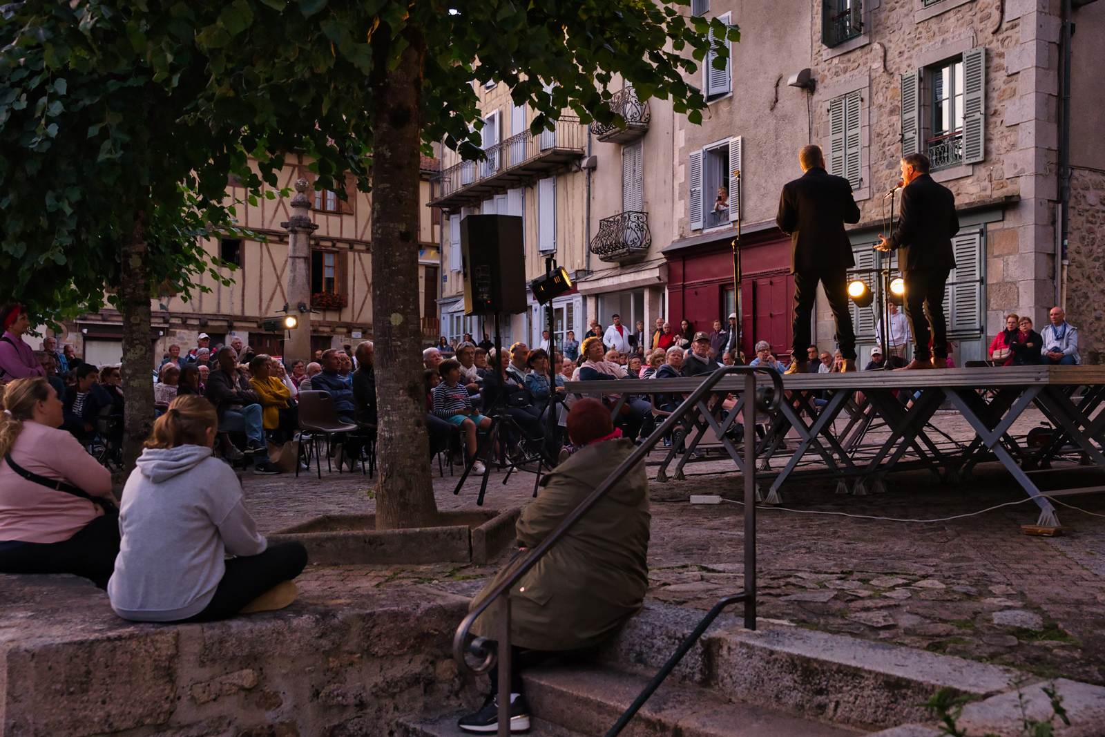
Laroquebrou International Boogie Woogie Festival
Over the years, this festival has become an unmissable event for boogie woogie fans - a music movement that emerged at the beginning of the 20th century. Today it's even known as the biggest boogie woogie festival in the world! With 5 days of festivities and 10,000 festival-goers roaming the city, this event welcomes dozens of artists from all over the world. From small performances in the historic centre to brass bands strolling down the main avenue, to big evening concerts and gospel concerts in the church, there's something for everyone at this summer festival !
Charcuterie, a culinary heritage
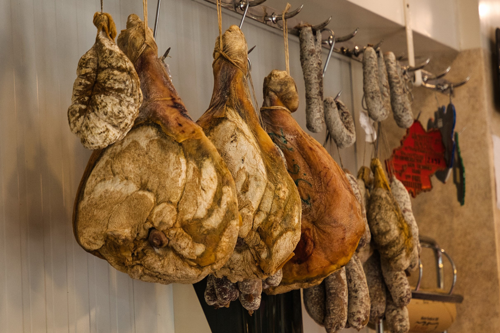
Charcuterie (dry pork meat) is a true culinary heritage, a know-how perpetuated for ages, strongly linked to the farming roots of the region. The culinary technique applied is a local tradition handed down from generation to generation. The town's local butchers are famous for their traditional charcuteries such as pâtés, dry sausages or even pounti (pork and sweet herbs meatloaf), and tasting them means enjoying exceptional local products ! This traditional know-how is celebrated at the Mangona Festival (pork culinary festival), where you can discover all the stages in the production and of course taste these famous charcuteries !
La Roquebrou, a lively little town
La Roquebrou can be visited through its architectural heritage, tasted through its culinary traditions and experienced through its people. Several annual events allow you to discover the medieval little town while tasting local charcuterie during the Mangona Festival, running during the Laroquapattes trail, enjoying the Medieval Festival, dancing during the Boogie Woogie and Swing Août Festivals in summer and taking part in the Book Fair.
Cère gorge
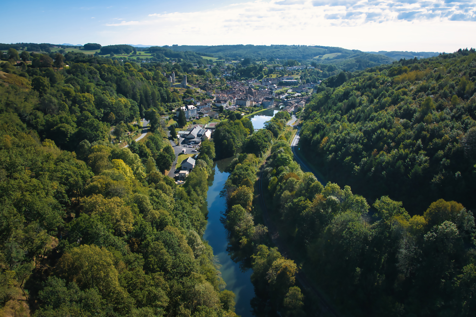
La Roquebrou is the gateway to the wild Cère Gorge,home to a wild range of biodiversity: booted eagle, short-toed eagle, bat species, reptiles, sedum hirsutum, three-leaved valerian... If you're feeling more sporty, you can discover them by walking the GR®652 or the Via Arverna. This 34-kilometre walk in the heart of nature also gives you the opportunity to observe dams and hydroelectric power stations. The River Cère, with all its natural resources, was a remarkable backdrop for the emergence of an economy based on crafts using water as a driving force.
La Roquebrou into Châtaigneraie Cantalienne
Petites Cités de Caractère® into Châtaigneraie
Mentions légales
Ce projet de carte interactive est porté par les associations Petites Cités de Caractère® de France, Petites Cités de Caractère® en Auvergne Rhône Alpes, Petites Cités de Caractère® du Cantal et par la commune de La Roquebrou.
Il est soutenu financièrement par l'Appel à Manifestation d'Intérêt "Destinations Digitales" du plan "Destination France" piloté par Atout France, par la convention FNADT du Commissariat Massif Central, par l'appel à projet "patrimoine et numérique" de la Région Auvergne Rhône-Alpes, et par la Fondation d’Entreprises du Crédit Agricole Centre France.
Le plan de la commune (visuel de fond) a été réalisé par Laura Catheline - atelier passage.
Les traductions en anglais ont été réalisées par l'Office de tourisme de la Châtaigneraie Cantalienne.
Les voix ont été produites et enregistrées par Hélène Poussin - Compagnie « les pieds bleus » (version française), Nico production (version anglaise).
Les photos ont été produites et réalisées par Antom Production - Anthony Moujol, Patrick Forget, Pierre Soissons, Stephanie Belaubre, Office de tourisme de la Châtaigneraie Cantalienne.
Les vidéos ont été produites et réalisées par Petites Cités de Caractère®, Leomedias.
Conception et développement de la carte interactive par Tabula Rasa.
![]()


![]()
Mentions légales
Ce projet de carte interactive est porté par les associations Petites Cités de Caractère® de France, Petites Cités de Caractère® en Auvergne Rhône Alpes, Petites Cités de Caractère® du Cantal et par la commune de La Roquebrou.
Il est soutenu financièrement par l'Appel à Manifestation d'Intérêt "Destinations Digitales" du plan "Destination France" piloté par Atout France, par la convention FNADT du Commissariat Massif Central, par l'appel à projet "patrimoine et numérique" de la Région Auvergne Rhône-Alpes, et par la Fondation d’Entreprises du Crédit Agricole Centre France.
Le plan de la commune (visuel de fond) a été réalisé par Laura Catheline - atelier passage.
Les traductions en anglais ont été réalisées par l'Office de tourisme de la Châtaigneraie Cantalienne.
Les voix ont été produites et enregistrées par Hélène Poussin - Compagnie « les pieds bleus » (version française), Nico production (version anglaise).
Les photos ont été produites et réalisées par Antom Production - Anthony Moujol, Patrick Forget, Pierre Soissons, Stephanie Belaubre, Office de tourisme de la Châtaigneraie Cantalienne.
Les vidéos ont été produites et réalisées par Petites Cités de Caractère®, Leomedias.
Conception et développement de la carte interactive par Tabula Rasa.
![]()
![]()