

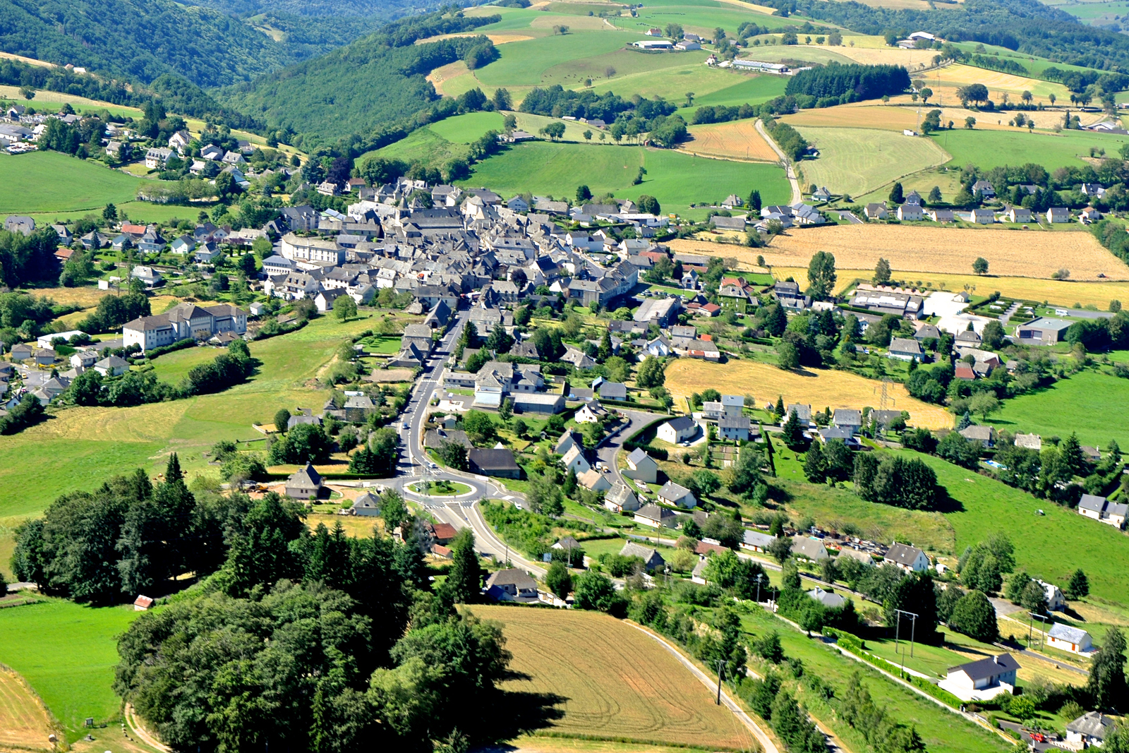
Montsalvy
Auvergne Rhône-Alpes, Cantal
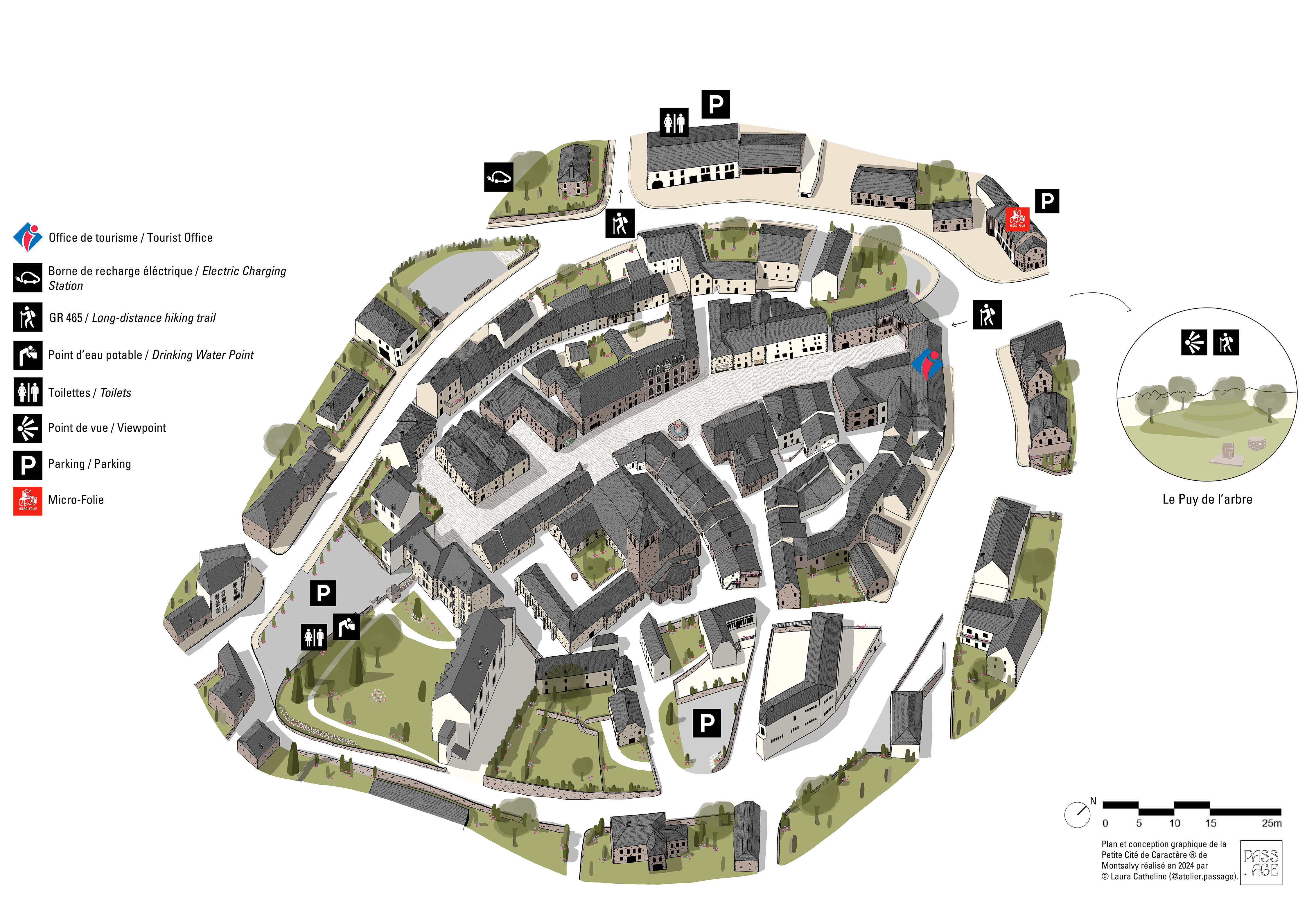
Montsalvy, Petite Cité de Caractère®
Montsalvy is designated Petite Cité de Caractère®. As such, it forms part of a national project aimed at promoting and protecting the architectural heritage of little towns across France. Through tourism, the initiative encourages visitors to embrace the local culture by strolling through the streets, learning about the history of the area, taking part in local events, and discovering the local way of life. In Cantal, there are several Petite Cité de Caractère® little towns to discover. The digital map will help you navigate each of them and highlight their main attractions.
Montsalvy, a former southern protected area
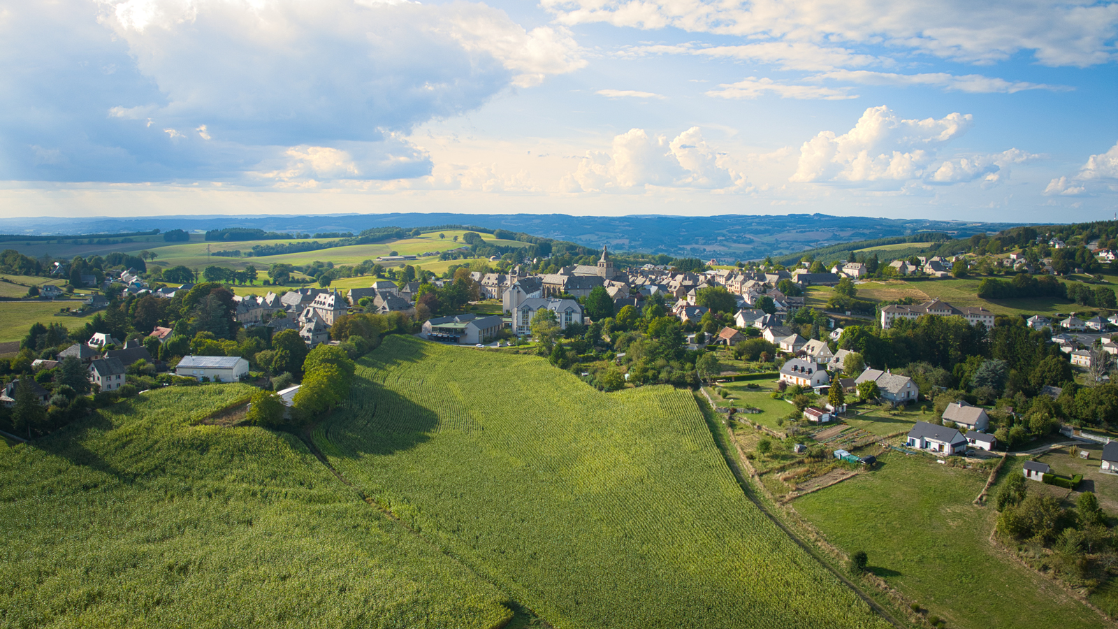
Montsalvy is located in the southern part of the Châtaigneraie, an area between the Cantal volcano and the Lot valley. In Montsalvy, all the roofs are grey and covered with lauzes (local stone tiles). Montsalvy was founded in 1070 by a monk called Gausbert, it was then a sauveté, a place where immunity was ensured to those who took refuge there, bounded by 4 crosses. Monte Salvii (Salvation Hill) seems to be the origin of its modern name "Montsalvy". Since the Middle Ages, it has been possible to enter the town through two arches. Don't miss the abbey church and the monks' refectory. A natural hill, the Puy de l'Arbre, overlooks the little town. From there, you will discover a magnificent panorama of the Cantal mountains and the Aubrac plateau.
Castle
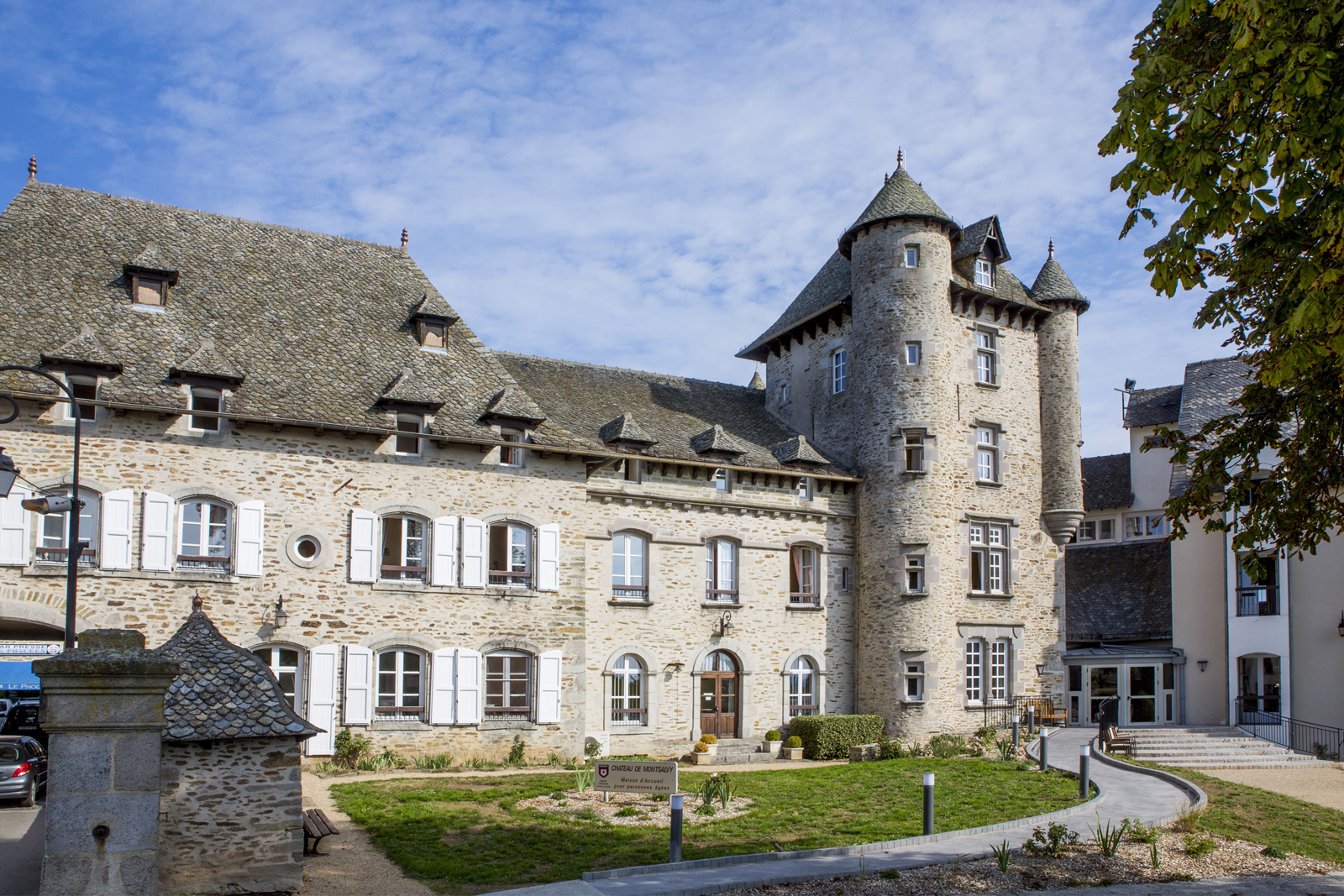
The castle, built on the old ramparts, is flanked by an elegant tower. A pretty roof in the shape of an upside-down boat hull protrudes from the wall enclosing the park. This roof shape, named after the great Renaissance architect Philibert Delorme, is fairly common in the region. Important cattle markets were held in the Place du Foirail on St. John’s and St. Martin’s Days. The Montsalvy market was also renowned for its hemp cloth and beeswax.
Southern Gate
The Southern Gate consisted of two large wooden doors supported by impressive hinges. In medieval times, it was reinforced with a portcullis. Also known as the Entraygues Gate, it was through this gate that the merchants and travellers coming from the south entered the town. The gate was enlarged in the 19th century and is now part of the castle. After the Wars of Religion (late 16th century), houses and gardens were built outside the ramparts. The two new suburbs (called barri in Occitan), St. Anthony and St. Francis, were protected from animal intrusion by a fence.
Monks' refectory
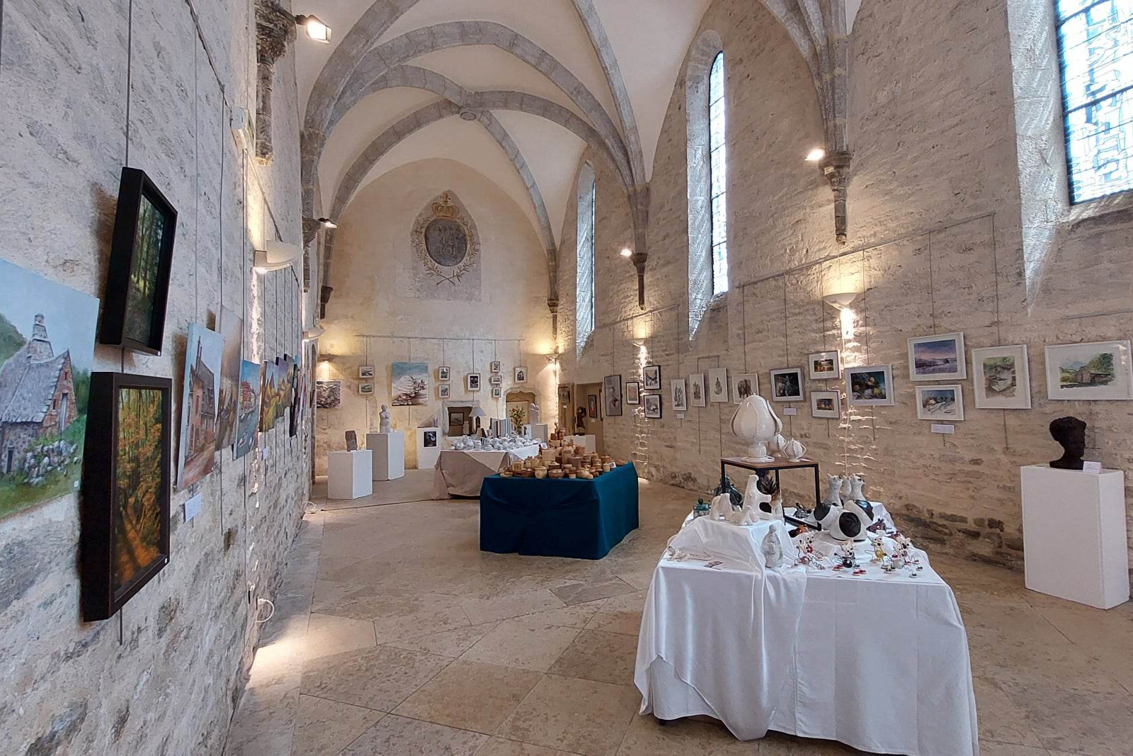
The refectory closed off the abbey’s cloister. Altered in the 14th and 15th centuries, it features vast ribbed vaults. Sold during the French Revolution, it became a community house and a school, then a granary, then a stagecoach and hearse garage, then a cinema. Listed as a French historical monument in 1982, the refectory was then completely restored in order to become an exhibition hall. Inside, a motto surrounded by laurel branches and topped by a fleur-de-lis surmounting a crown perhaps witnessed the loyalty of the local abbot to the king of France.
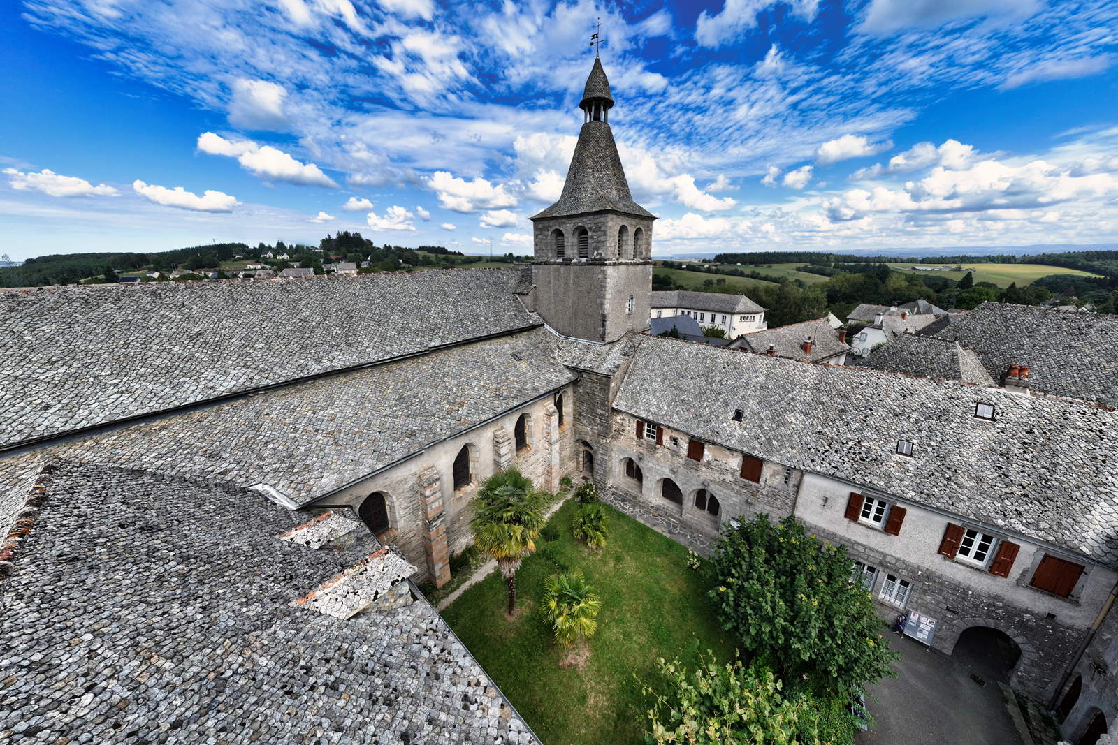
Cloister of St. Gausbert
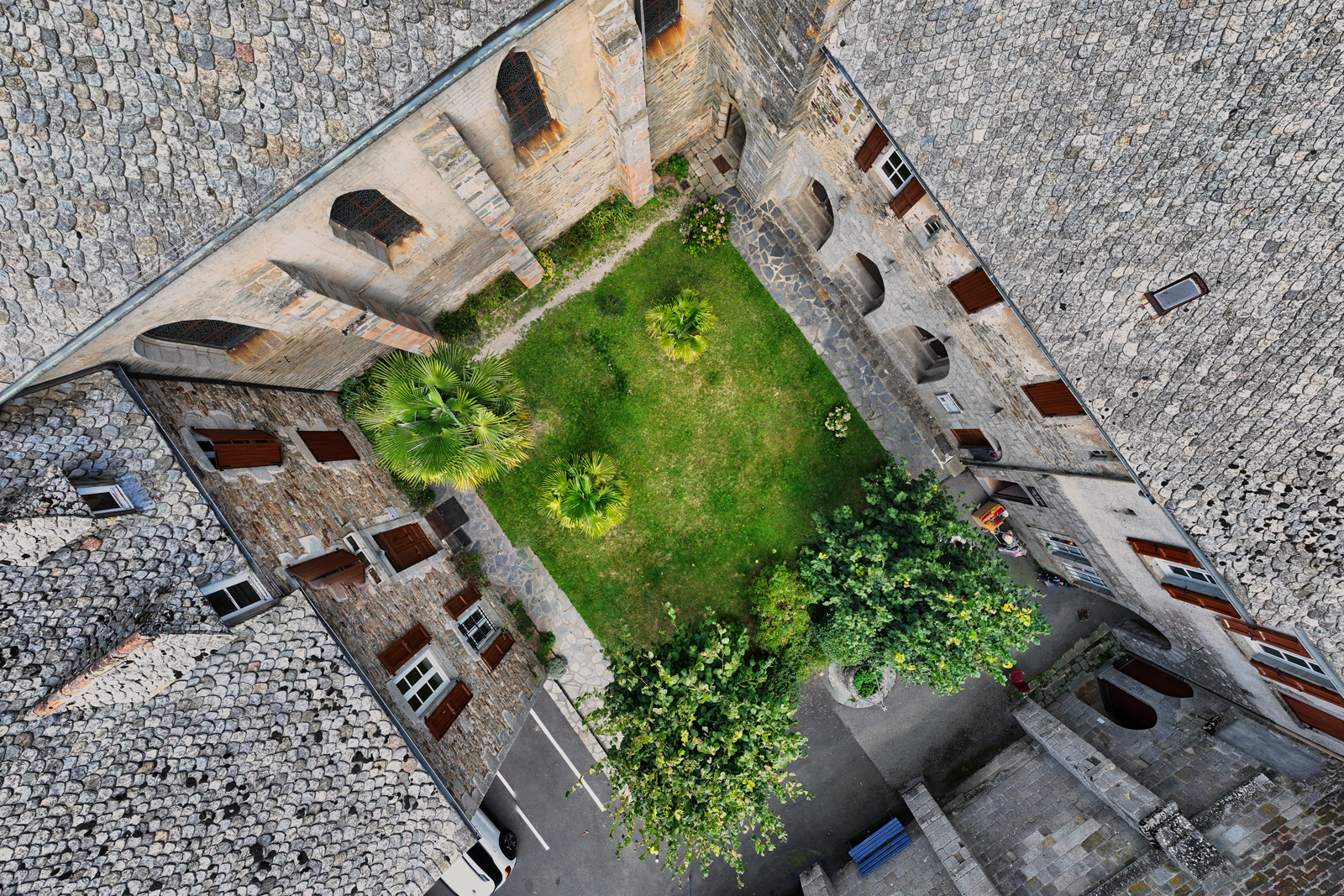
Until 1867, the cloister was covered by a gallery decorated with carved capitals. Some of them are displayed in the chapter house, which is enclosed by three Gothic windows. The cloister is dominated by the bell tower, off-centered after having been struck by lightning in 1258. The remains of a well and of a granite sink leaning against the wall are still visible. Two pieces of metal sealed into the wall of the chapter house were used to ensure the accurate measurement of wool and hemp fabrics, a major activity in Montsalvy.
Romanesque apse
You are standing at the back of the church, the 11th-century Romanesque apse of which is the oldest part. On either side of this apse are two semicircular apse chapels. A so-called “poor people’s” cemetery was located here until the 18th century. Note the modillions under the roofs, depicting human or animal heads and surprisingly modern geometric motifs.
Weaver's house
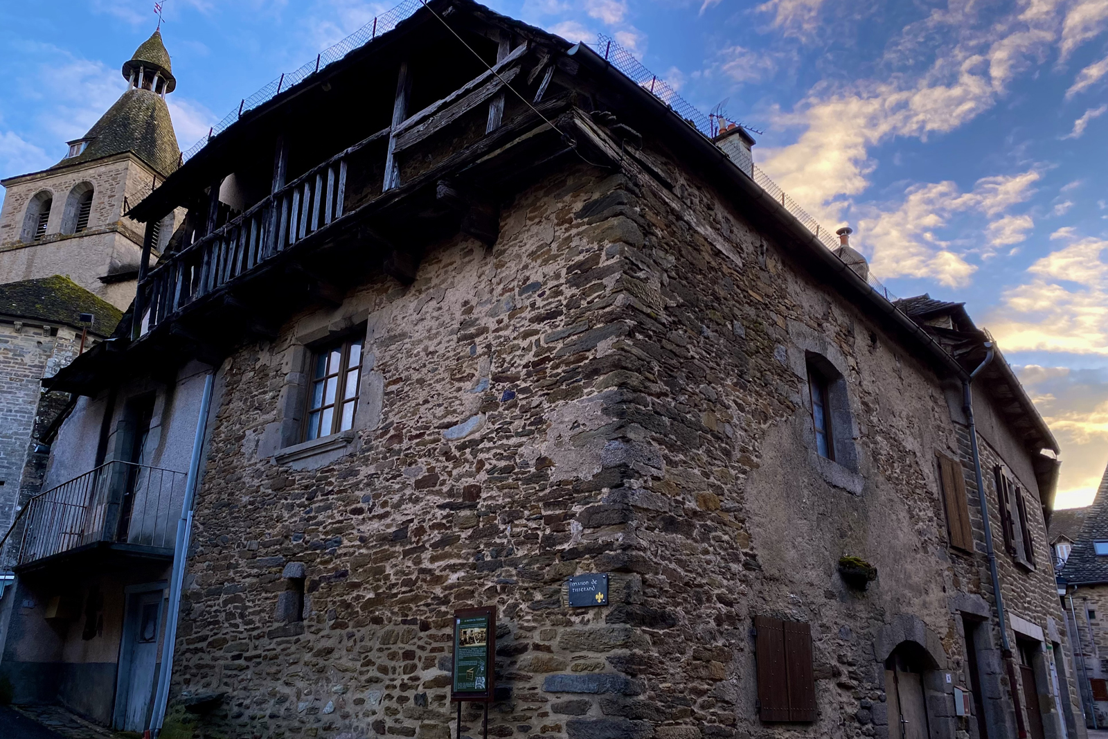
From the Middle Ages to the 20th century, the manufacture of woollen and hemp clothing was a flourishing industry in Montsalvy. Hemp was widely grown here, as the plant has long fibres and therefore creates very strong fabrics. The recognised expertise of the weavers enabled them to sell their strong, lightweight fabrics to the navy. The weaver's house still retains one of the last wooden balconies used to dry the hemp.
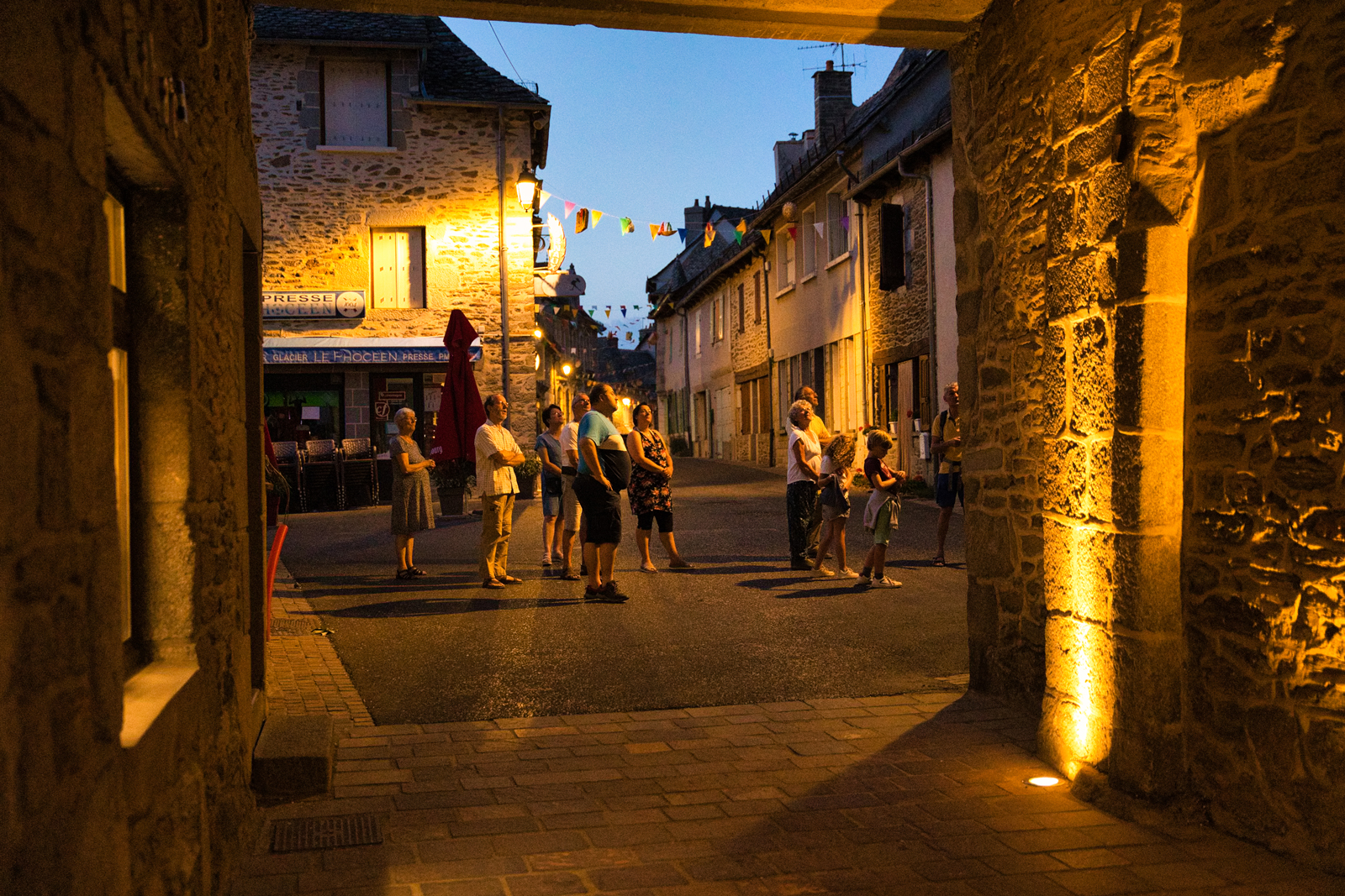
Wicker and Weaving Festival
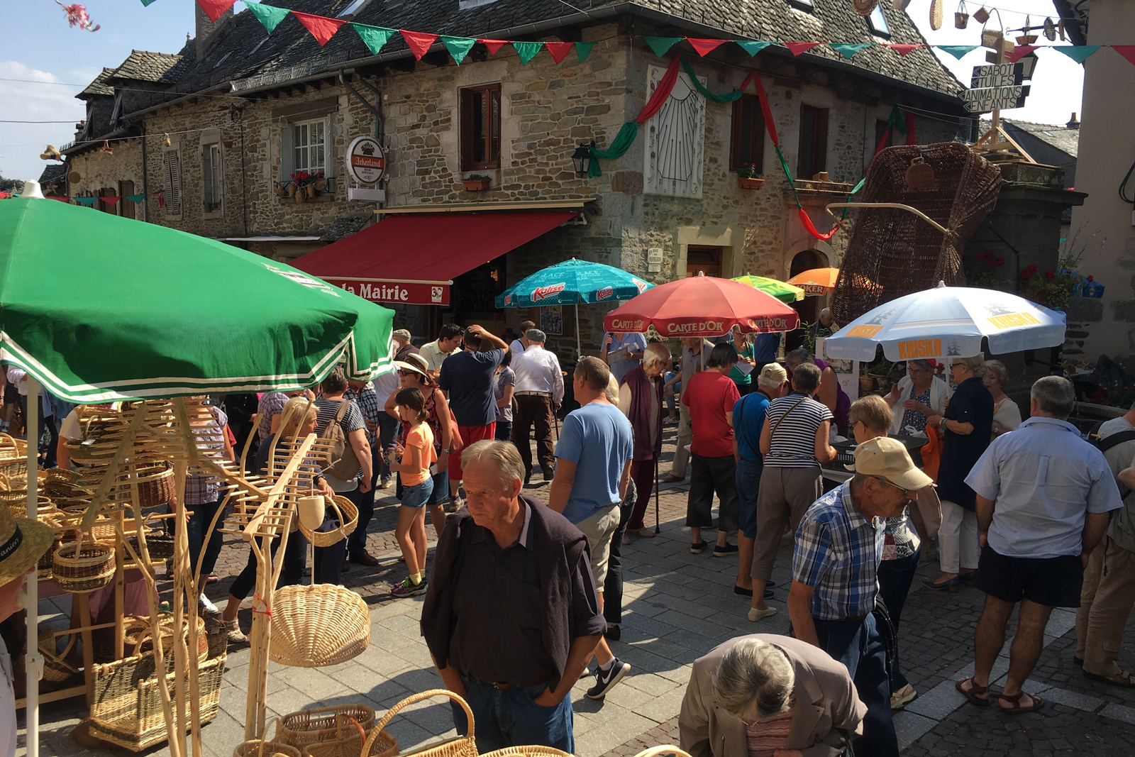
Every year on the last Saturday in July Montsalvy hosts the Baskets Festival. Basketry is an important part of the cultural and handicraft tradition of Montsalvy. During the festival, basket makers from all over France come to share their know-how and sell their baskets. Throughout the year, you can take part in training sessions and learn how to make wicker or chestnut baskets, with the aim of preserving this intangible heritage of Montsalvy.
End of the World Square
The Place de la Fin du Monde ends in a cul-de-sac, hence its name. All the houses were connected to each other and their façades follow the line of the old ramparts leading to the Northern Gate. In case of danger, the cattle were gathered into the square and the people could move from one house to another to defend themselves.
Fortified Gate
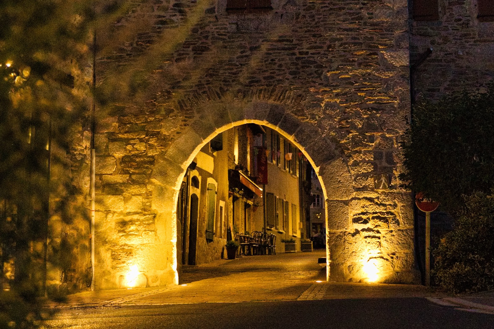
The Northern Gate is called the Aurillac Gate. People coming from Aurillac could stop at Montsalvy on their way to Rodez. They had to pay a toll: The king's representative levied a tax on all goods, including transhumant livestock. Like the Entraygues Gate, which was more altered, the first floor of this half-timbered structure was used as a guard room. In the evening the gate was closed by two doors.
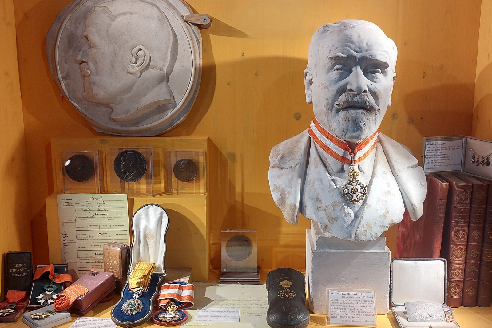
Marcellin Boule cabinet of curiosities
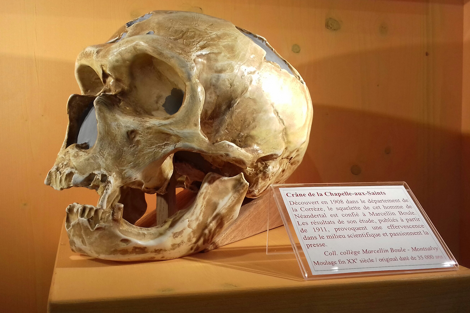
The Tourist Office is home to the Marcellin Boule cabinet of curiosities. Marcellin Boule was an eminent palaeontologist, an eclectic and Darwinian scholar, born in Montsalvy in 1861. While holding the chair of Palaeontology at the National Museum of Natural History in Paris, he was entrusted with the study of Neanderthal skulls and skeletons and published his findings in his major work, “Les Hommes fossiles” (The Fossil Men). He founded the Museum’s Gallery of Paleontology and Comparative Anatomy and the Institute of Human Palaeontology in Paris. He popularised science by publishing scientific tourist guides and textbooks. Very attached to his home town, Boule died there in 1942.
"Grifol" Fountain
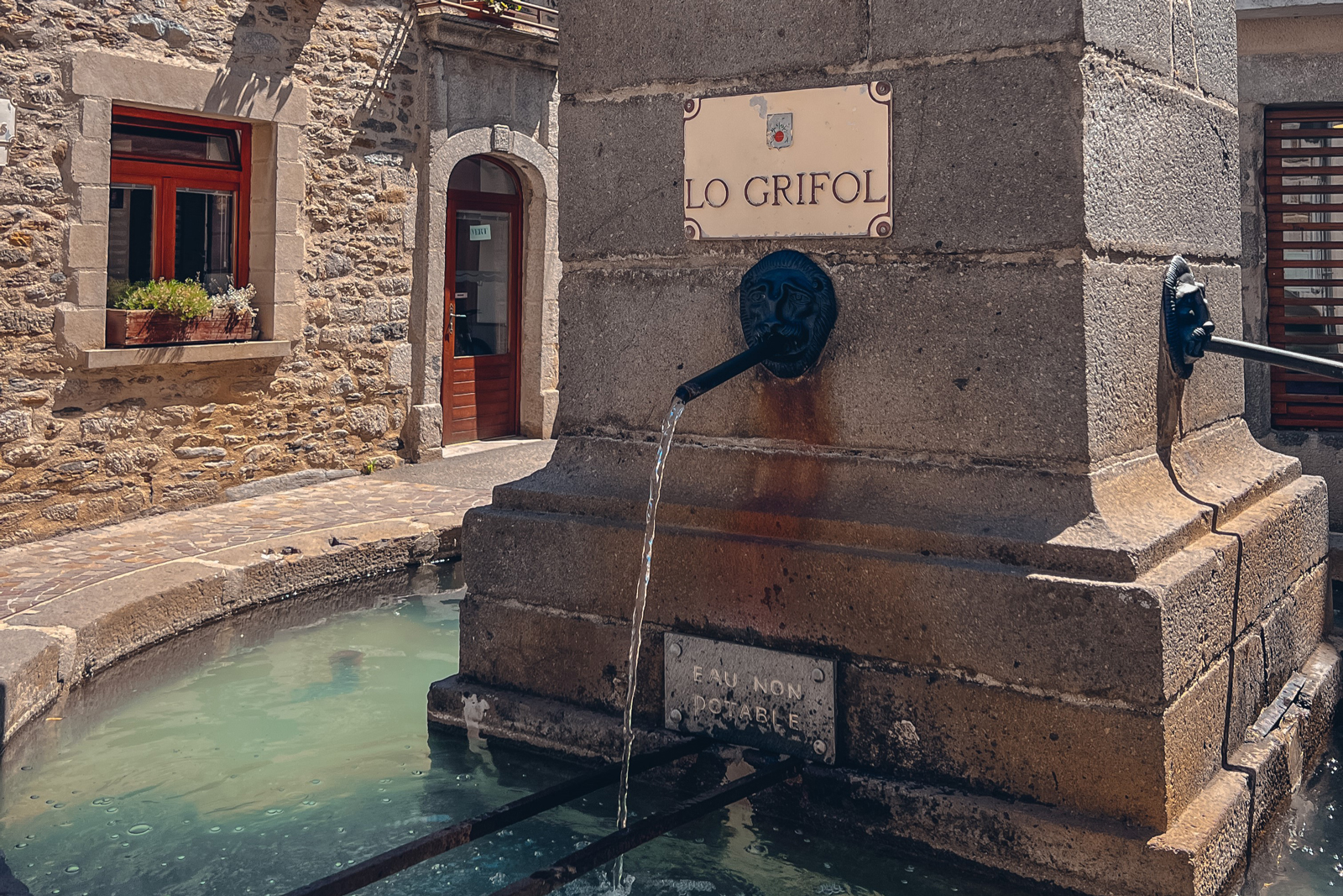
Years ago, public fountains were the only places where people could be supplied with water. The fountain was first called "Lora", until the 19th century when the column supporting the four griffins and the two basins were built: one for human consumption, the other for watering animals. At the beginning of the 20th century, as Montsalvy was affected by typhoid fever, Marcellin Boule proposed to tap the water from a spring called "Silver Fountain", which thereby stemmed the tide of epidemics. On the wall behind, the century-old sundial was restored in 1988.
Former school
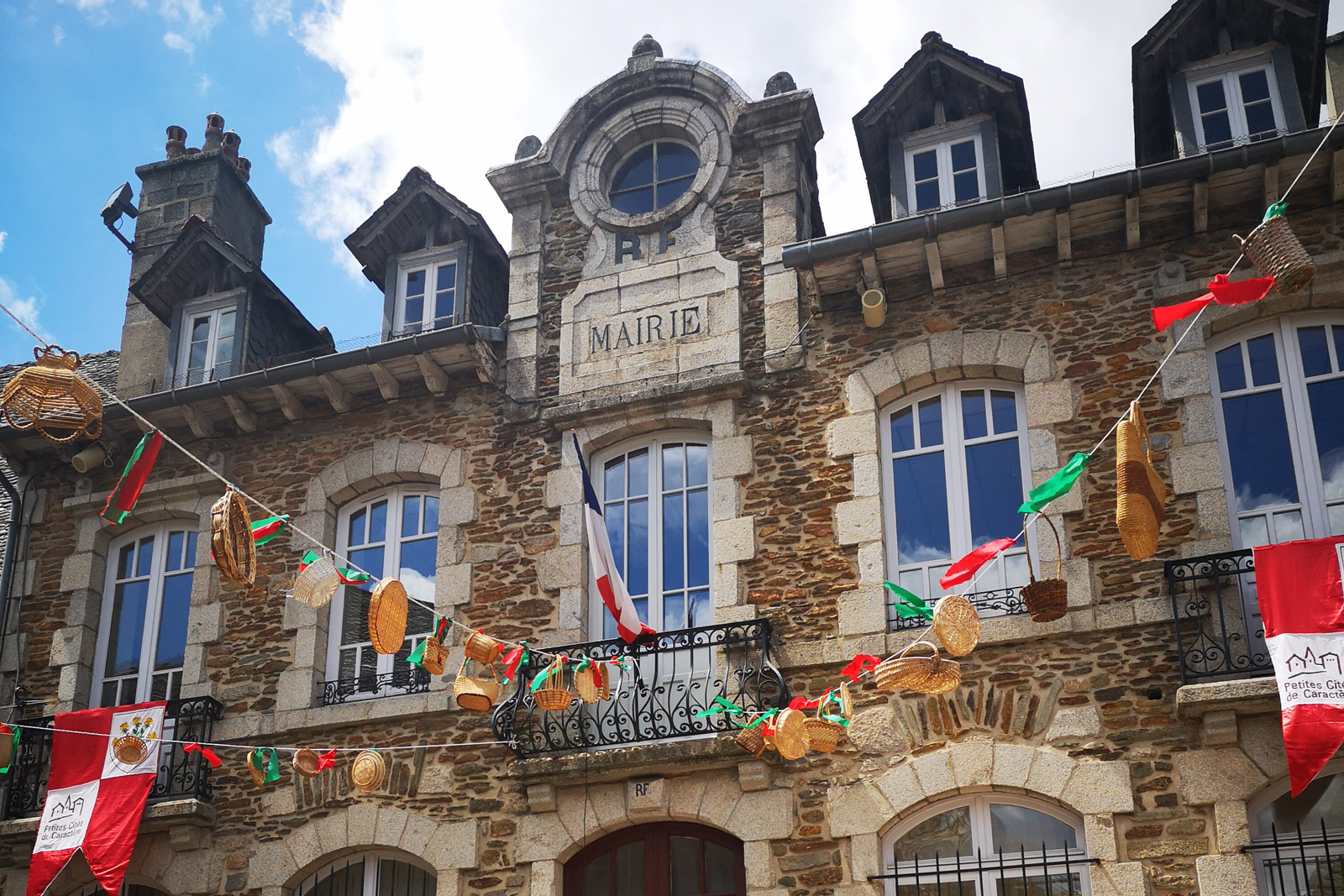
Inaugurated in 1909, the town hall was initially the public boys’ school. On the Rue Basse des Remparts, some features common to all schools in the first half of the 20th century remain visible: a shaded courtyard, a playground and a latrine.
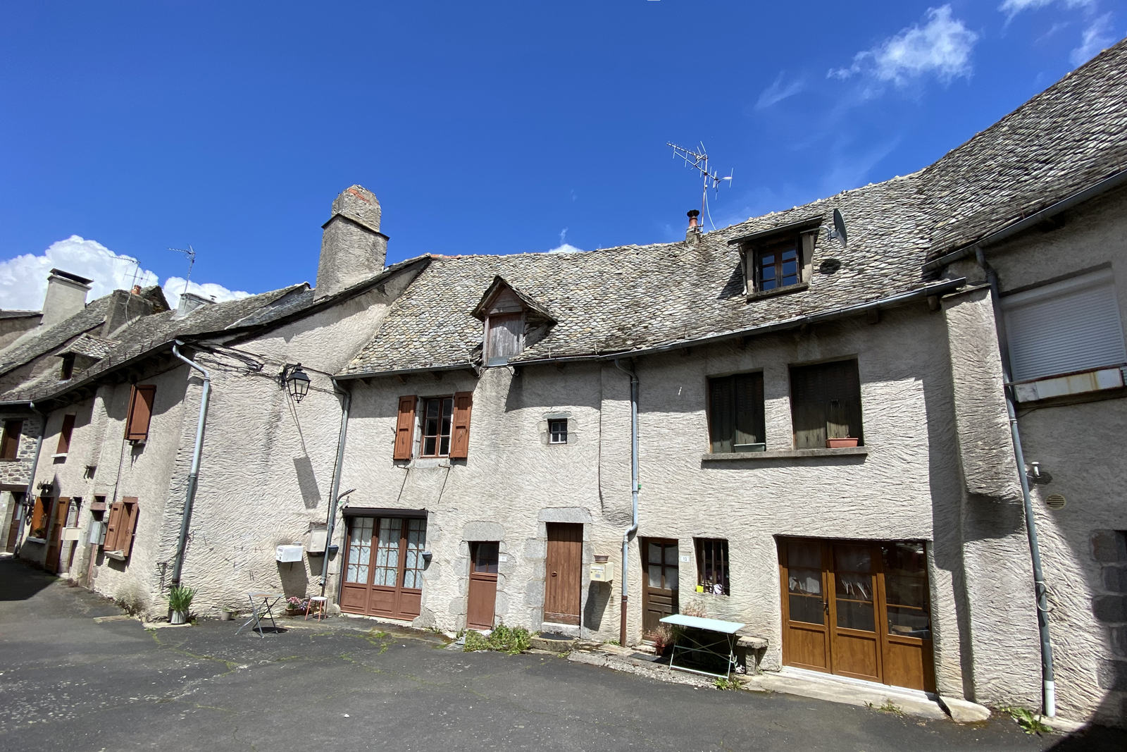
Half-timbered houses
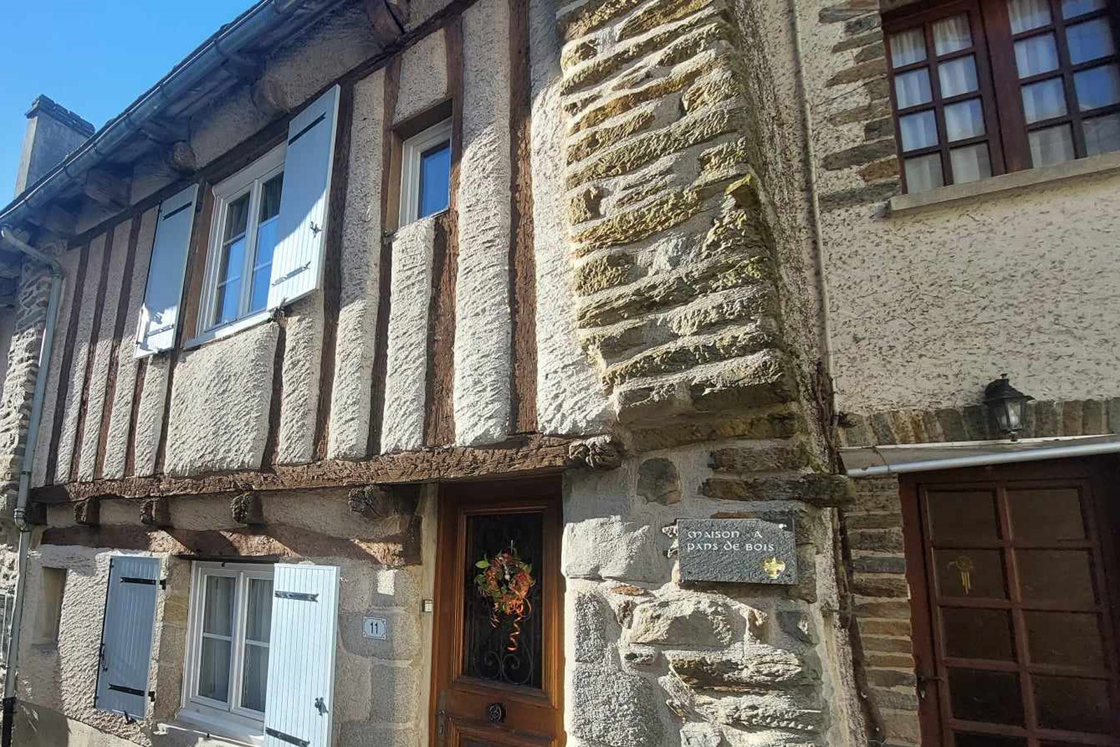
Timber was used traditionally to build houses from the late Middle Ages to Modern times. The house usually features two rooms opening onto the street. Stone was only used for the cellar, the foundations and the corners of the house. The timber frame was filled with cob (mixed mud and straw or sometimes with a lime mortar) and was not meant to be seen: The wood was carved so that the coating clings to the timbers. The corbelled upper levels increased the living space while protecting the ground floor stall from the rain.
Corner turret
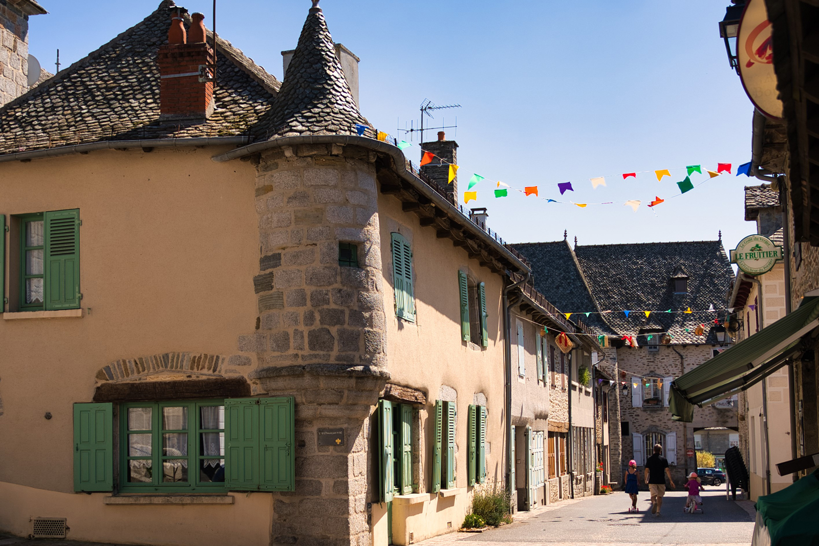
The pretty corner turret gives this house a touch of medieval charm. However it has not been built for defensive purposes, and therefore has no loopholes like medieval watchtowers. Here the tower is for aesthetic purposes. This turret illustrates the extent to which the collective imagination was long impressed by the medieval era. It dates back to the 17th century, when the provost of the Montsalvy was allowed to extend his house in exchange for payment to repair the town wall.
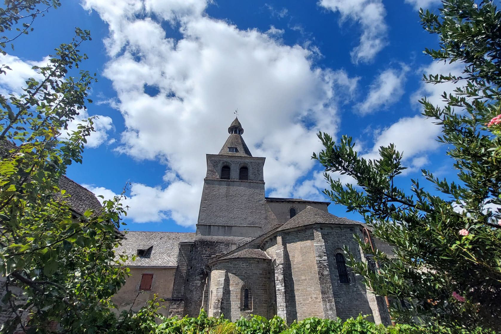
Montsalvy abbey
The abbey of Montsalvy, built in the 11th century, was one of the most important abbeys in the area. Around the abbey, a protected area (sauveté) was created, bounded by four crosses. People came there to seek refuge from feudal conflicts. A little town was born. In the square, note the wrought-iron cross depicting the Instruments of the Passion (or “Arma Christi”). It was hidden during the French Revolution, although the date 1800 inscribed on its granite base suggests that it was built later.
Religious art
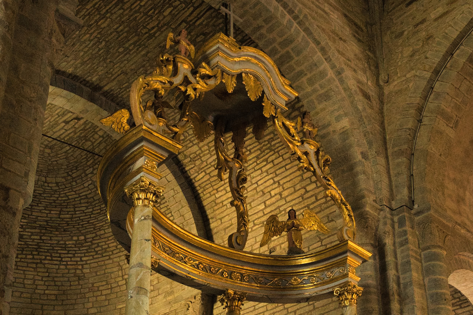
Inside the church, an outstanding wooden and polychrome Romanesque Christ dated back to the 10th or the 11th century. The golden wooden altar standing in the middle of the Romanesque choir dates back to the 19th century. Two of the four boundary crosses, the St. Anne’s Cross and the Cambon Cross, have found shelter in the church. On each side of the choir are exhibited the reliquary of St. Gausbert, who founded Montsalvy, and the reliquary of St. Bernard, patron saint of the town. On the right side, the chapterhouse houses the exceptional Montsalvy Treasure of sacred art.
Treasure of sacred art
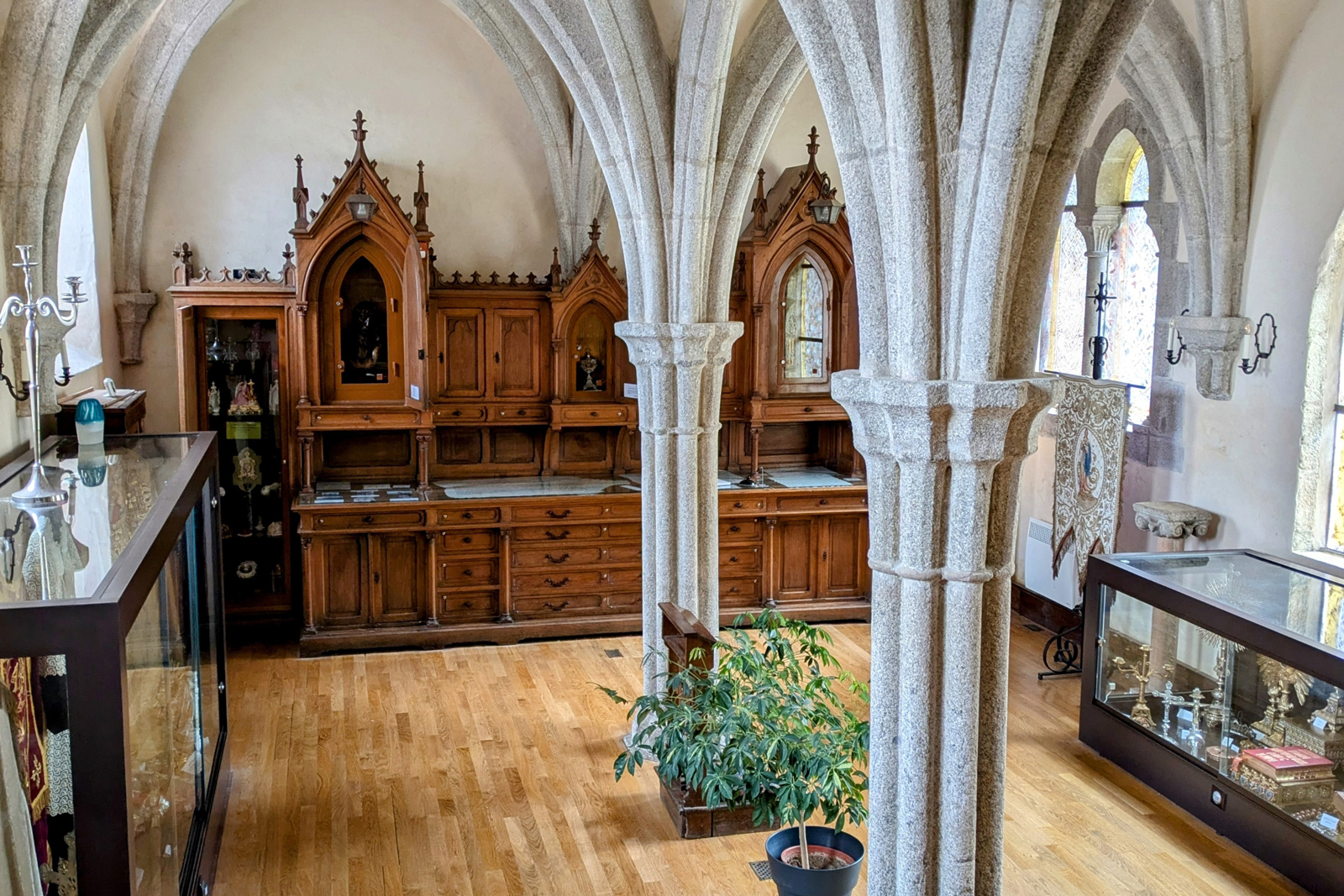
Enter the chapter house, where two monolithic columns support the 14th century vaults. Priestly objects coming from various churches in the area. Some of them are listed in the French Monuments Historiques. Popular priestly objects as well as interesting examples of popular liturgical art, such as a Junhac collecting box made from a reworked copper pan, and a collection of home stoups are exhibited in the chapter house. Some capitals from the former cloister gallery are on display there. On the right, three Gothic openings have featured thermoformed stained-glass windows since 2005.
Puy de l'Arbre
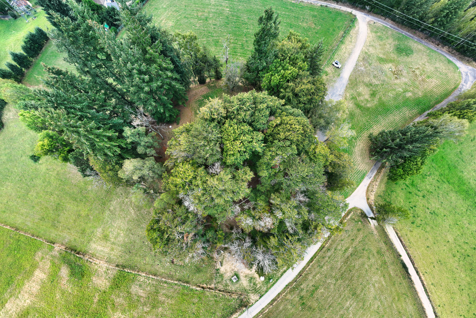
This hill was once home to the Château de Mandulphe, an unusual name of Germanic origin. It was built in the late 10th century by the Viscounts of Carlat to keep watch over the region and control the route linking Southern France to the Mounts of Cantal. In 1477, the castle was destroyed by order of King Louis XI, who was at odds with Viscount Jacques d'Armagnac. The foundations of the feudal fortress, which resembled a volcano, can still be seen today. After the French Revolution, it was decided to unify the various units of measurement. Two astronomers, Delambre and Méchain, were appointed to measure a so-called Paris meridian arc between Dunkirk and Barcelona. In 1797 Delambre chose the Puy de l’Arbre as one of the triangulation stations from which he defined the length of the metre. The site was converted into a promenade in 1875. Since 1972, it has been a protected site.
Micro-Folie Digital Museum
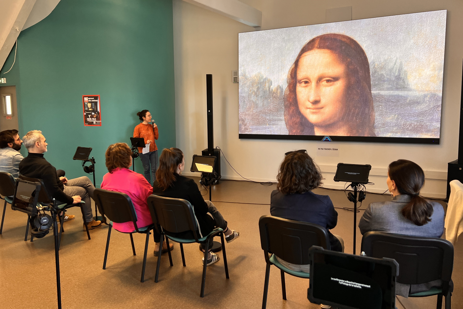
The Micro-Folie de la Châtaigneraie Cantalienne is an innovative digital museum offering an extraordinary journey through art and history. More than 3000 high-definition digital versions of works of art from national and international collections can be admired on a large screen. Art and its history, from Ancient Egyptian to the beginning of the conquest of space, can be explored in a fun and interactive way.
Grimaldi historical site
Montsalvy was part of the viscounty of Carlat. This affiliation explains why the oldest documents of the sauveté of Montsalvy are kept in the Principality of Monaco. In the 17th century, the Prince of Monaco did not want to remain under Spanish control. In 1641, King Louis XIII took Monaco under his protection under the Treaty of Péronne and donated to the Prince the viscounty of Carlat, which remained the property of Monaco until the French Revolution. A more recent link exists between the Principality of Monaco and Montsalvy. In fact, Marcelin Boule and Prince Albert I were friends, and the latter entrusted the former with the direction of the archaeological digs at the Grimaldi caves, which provided important information on human evolution.
GR465 trail
To discover nature and history, follow the GR465 hiking route. This Cluniac route links Murat to Conques, crossing the Mounts of Cantal. Along the way, Montsalvy is a popular stop-off point because of its landscape and religious heritage. As you approach Montsalvy, the abbey bell tower stands out in the landscape as a reminder of its great historical heritage. In Conques the route joins the Via Podiensis, the main pilgrimage Way of Saint James leading to Santiago de Compostela.
Montsalvy into Châtaigneraie Cantalienne
Petites Cités de Caractère® into Châtaigneraie
Mentions légales
Ce projet de carte interactive est porté par les associations Petites Cités de Caractère® de France, Petites Cités de Caractère® en Auvergne Rhône Alpes, Petites Cités de Caractère® du Cantal et par la commune de Montsalvy.
Il est soutenu financièrement par l'Appel à Manifestation d'Intérêt "Destinations Digitales" du plan "Destination France" piloté par Atout France, par la convention FNADT du Commissariat Massif Central, par l'appel à projet "patrimoine et numérique" de la Région Auvergne Rhône-Alpes, et par la Fondation d’Entreprises du Crédit Agricole Centre France.
Le plan de la commune (visuel de fond) a été réalisé par Laura Catheline - atelier passage.
Les traductions en anglais ont été réalisées par l'Office de tourisme de la Châtaigneraie Cantalienne.
Les voix ont été produites et enregistrées par Hélène Poussin - Compagnie « les pieds bleus » (version française), Nico production (version anglaise).
Les photos ont été produites et réalisées par Antom Production - Anthony Moujol, Pierre Soissons, Mairie de Montsalvy, Communauté de Communes Châtaigneraie Cantalienne, Petites Cités de Caractère®, Office de tourisme de la Châtaigneraie Cantalienne, Marjorie Rodde Instameet OT Châtaigneraie.
Les vidéos ont été produites et réalisées par Petites Cités de Caractère®, Leomedias.
Conception et développement de la carte interactive par Tabula Rasa.
![]()
![]()